Sign In

My Timeline

GuRoute

Discover Your World

Share your Experiences

Record your Life


New Zealand

Auckland Region

The Auckland Region is one of the sixteen regions of New Zealand, named for the city of Auckland, the country's largest urban area. The region encompasses the Auckland metropolitan area, smaller towns, rural areas, and the islands of the Hauraki Gulf. With 34 percent of the nation's residents, it has by far the biggest population and economy of any region of New Zealand, but the second-smallest land area. On 1 November 2010, the Auckland Region became a unitary authority controlled by the Auckland Council, replacing the previous regional council and seven local councils. In the process, an area in its southeastern corner was transferred to the neighbouring Waikato Region. The name "Auckland Region" remains present in casual usage. On the mainland, the region extends from the mouth of the Kaipara Harbour in the north across the southern stretches of the Northland Peninsula, past the Waitakere Ranges and the isthmus of Auckland and across the low-lying land surrounding the Manukau Harbour. The region ends within a few kilometres of the mouth of the Waikato River. It is bordered in the north by the Northland Region, and in the south by the Waikato Region. It also includes the islands of the Hauraki Gulf. The Hunua Ranges and the adjacent coastline along the Firth of Thames were part of the region until the Auckland Council was formed in late 2010, when they were transferred to the neighbouring Waikato Region. In land area it is smaller than all the other regions and unitary authorities except Nelson. Its highest point is the summit of Little Barrier Island, at 722 metres. The Pacific Ocean and Tasman Sea form the coastline around the Auckland region. The east coast is lapped by the waters of the Hauraki Gulf, an arm of the Pacific sheltered by a considerable number of small and large islands, notably Great Barrier Island in the northeast. An arm of the Gulf, the Waitemata Harbour, forms the main harbour of Auckland city, and also accommodates New Zealand's largest port. The mainland coastline is 1,613 kilometres long. Much of the coastal marine area comprises sensitive tidal inlets and estuaries and semi-enclosed Waitemata, Manukau and Kaipara Harbours. To the west lie two large natural harbours, the Kaipara and the Manukau. Both of these have treacherous entrances and are little used by shipping. The Kaipara Harbour (of which the southern half is in the Auckland region) is one of the world's largest natural harbours, covering an area of 530 square kilometres (200 sq mi). The Manukau Harbour, located in the southwest part of the region, has a small port at Onehunga, but also suffers from difficult navigation – especially when the predominant southwesterly wind is blowing. Auckland Airport is located on the edge of the Manukau Harbour. The region is blessed with many fine beaches, especially on the Tasman coast south of the Kaipara. These include Muriwai and Piha beaches. The Auckland Region is built on a basement of greywacke rocks that form many of the islands in the Hauraki Gulf, the Hunua Ranges, and land south of Port Waikato. The Waitakere Ranges in the west are the remains of a large andesitic volcano, and Great Barrier Island was formed by the northern end of the Coromandel Volcanic Zone. The main isthmus and North Shore are composed of Waitemata sandstone and mudstone, and portions of the Northland Allochthon extend as far south as Albany. Little Barrier Island was formed by a relatively isolated andesitic volcano, active around 1 to 3 million years ago. The Manukau and South Kaipara Harbours are protected by the recent sand dune deposits of the Awhitu and South Kaipara Peninsulas. Recent basaltic volcanic activity has produced many volcanic cones throughout the Auckland Region, including the iconic Rangitoto Island. Much of Auckland's urban area lies on top of the dormant Auckland Volcanic Field. The region is dotted by 49 volcanoes of varying age with the oldest being in the region of 150,000 years old. The most recent eruption occurred approximately 600 years ago, ending a few hundred years of activity during which Rangitoto Island was formed. Each volcanic eruption has tended to be bigger than the previous, with Rangitoto making up almost 60% of the entire volume of erupted material. All of the volcanoes are relatively small, most being less than 150 metres (490 ft) in height. A large number of the Auckland volcanoes have been levelled or strongly altered – in small part due to historical Māori use of the cones as fortified pā or for terraced fields, but for most part having been quarried relatively recently for roading and construction materials (mainly scoria). However measures are now in place to preserve many of the remaining volcanoes as landmarks and parks. Despite its small area, the region is by far the most populous in New Zealand, with a population of 1,570,500 (June 2015 estimate), 34.2% of the country’s population. The Region is growing faster than any other part of the country except Tauranga, with its population increasing by over 240,000 (22%) in the past 10 years (according to Census data from 1996, 2001 and 2006). According to the 2001 Census, the Auckland Region contains 26.3 percent of New Zealand's European population, 24.3 percent of the Māori population, 66.7 percent of the Pacific peoples population, 63.7 percent of the Asian population and 54.7 percent of the population in the 'Other' ethnic groups category. These statistics highlight the ethnic diversity of the Auckland Region, compared to the rest of New Zealand.

Manawatu Wanganui

Manawatu-Wanganui is a region in the lower half of the North Island of New Zealand, whose main population centres are the cities of Palmerston North and Whanganui. It is administered by the Manawatu-Wanganui Regional Council, which for trading purposes is known as Horizons Regional Council. The region is dominated and defined by two significant river catchments, the Whanganui and the Manawatu. The Whanganui River, in the northwest, is the longest navigable river in New Zealand. The river was extremely important to early Māori as it was the southern link in a chain of waterways that spanned almost two-thirds of the North Island. It was one of the chief areas of Māori settlement with its easily fortified cliffs and ample food supplies. Legends emphasise the importance of the river and it remains sacred to Wanganui iwi. Māori along the coast and lowland plains grew kumara and other crops. The Manawatu River runs across the centre of the region, from rolling hill country in the east to the fertile Manawatu Plains in the west. The main city of Palmerston North is located on these plains, and is an important service city for the southern North Island as a whole. This river is unusual, in that it passes from hill country to plains through a gorge cut into much higher country, an indication that the hills have risen since the river formed. To the southeast, a further, more sparsely populated area lies between the sources of the Manawatu River and the Pacific coast. This area, often historically connected with both the Hawke's Bay region to the north and the Wairarapa to the south, was historically simply known as Bush, a name which still survives in some businesses and organisations, most notably in the name of the Wairarapa-Bush Rugby Football Union. The two river catchments have very different natures. While the open Manawatu Plains became more densely settled by Europeans, inland Ruapehu, Rangitikei and Wanganui remained more Māori-dominated, remote and independent, and is still heavily forested. As late as the 1950s the Whanganui River remained a river of mystery. Since then exploitation of the river's commercial potential has opened up the area, often causing friction with local Māori, who have long-standing grievances. Manawatu-Wanganui as a whole is one of the most important pastoral areas in New Zealand, its status recognised when the government opened the Massey Agricultural College in the 1920s. Much of Manawatu-Wanganui was fertile and bush-covered when Europeans arrived and developed the area as a source of timber. Saw milling and flax milling dominated the 19th century, followed by an influx of sheep farmers who exploited the newly cleared ground. Deforestation, burn-offs of timber and scrub and large scale drainage combined with overgrazing, resulted in considerable environmental degradation. In the early 1900s authorities realised that careful management was needed to maintain this important agricultural area. Manawatu-Wanganui takes up a large proportion of the lower half of the North Island. It is the second-largest local government region in the North Island and the sixth-largest in New Zealand, totalling 22,215 km2 (8.1% of New Zealand's land area). The region stretches from north of Taumarunui to south of Levin on the west coast, and across to the east coast from Cape Turnagain to Owhanga. It borders the Waikato, Taranaki, Hawke's Bay and Wellington regions and includes river catchment areas that run from the volcanic plateau to the sea. The Pacific Ocean is the eastern boundary and the Ruahine Ranges form a natural boundary with Hawke's Bay. The area includes a variety of landscape formations. Districts close to the Volcanic Plateau are higher and more rugged, often subject to harsh temperatures in winter. The Manawatu District has a much gentler topography, consisting mainly of the flat, tree-studded Manawatu Plains that run between the ranges and the sea. The land was under the sea till about 500,000 years ago and still has a very thick layer of marine sediment, which is about five or six million years old. A block faulting system underneath the thick sediment has raised a series of domes and gentle depressions. These structures can provide natural storage areas for oil and some of the Manawatu domes have been drilled. The domes have shaped the course of the Manawatu River, giving it a meandering path which, uniquely among New Zealand rivers, begins close to the east coast and exits on the west coast. The Manawatu River begins just inside the Hawke's Bay region, then flows through a deep gorge to the Manawatu Plains before exiting in the Tasman Sea. The river is also unique in New Zealand (and rare worldwide) in that this gorge (the Manawatu Gorge) is a water gap through recently uplifted rock, causing the river to flow from relatively low-lying land along an eroded course through higher terrain. The Wanganui District is more rugged, with canyon-like valleys and gorges carved out of the soft rock by rivers and ocean waves. The region includes a series of mountain ranges, notably the Tararua and the Ruahine Ranges and the three major active volcanoes of the North Island. Mount Ruapehu at 2,797 m is the tallest mountain in the North Island, Ngauruhoe 2,291 m and Tongariro 1,968 m. During the last 100 years Ruapehu has experienced six significant eruptions, and last erupted in 1995 and 1996. Three major rivers divide the region: the Whanganui (290 km), Manawatu (182 km) and Rangitikei (241 km). The Whanganui is the second-longest river and has the second-largest catchment in the North Island, draining most of the inland region west of Lake Taupo. There are few roads in this area, which contains some of the largest surviving areas of native bush in the North Island. The region contains areas of great ecological significance, reflected in the designation of approximately a seventh of its land area as part of the nation's conservation estate. Tongariro National Park is the largest park in the region (795.98 km2) and is the oldest national park in the country, established in 1887. The volcanoes Tongariro, Ruapehu and Ngauruhoe are sacred to Māori and were given to the nation by Te Heuheu Tukino IV, paramount chief of Ngati Tuwharetoa. They form the nucleus of the park, which is designated a world heritage area. Whanganui National Park is slightly smaller (742.31 km2) and was established 99 years later when a series of reserves were incorporated into one area and given national park status. There are two state forest parks in the rugged, bush-clad Ruahine and Tararua Ranges. The four parks offer skiing, tramping, jetboating and white-water rafting and the opportunity to appreciate the environment. The regional council, responsible for managing natural and physical resources, provides flood protection and monitors environmental problems such as pest infestation and pollution. Invasive plant pests such as African feathergrass, goats rue and nodding thistle pose a threat to pastureland in this heavily agricultural-dependent region, and the council has instituted control campaigns. The council has also instituted animal pest control programmes. Possums are perceived as the major animal pest since they damage native forests and endanger cattle production through the spread of bovine tuberculosis. Eradication programmes also concentrate on rabbits, rooks and feral goats, while other exotic species such as Parma wallaby (Macropus parma), wasps, ferrets, stoats and weasels are a source of concern.

Otago Region

Otago (; New Zealand [əˈtɐːɡɐʉ̯]) is a region of New Zealand in the south of the South Island administered by the Otago Regional Council. It has an area of approximately 32,000 square kilometres (12,000 sq mi), making it the country's third largest local government region. Its population was 215,100 in the June 2015 estimate. The name "Otago" is an old southern Maori word whose North Island dialect equivalent is "Otakou", introduced to the south by Europeans in the 1840s. The exact meaning of the term is disputed, with common translations being "isolated village" and "place of red earth", the latter referring to the reddish-ochre clay which is common in the area around Dunedin. "Otago" is also the old name of the European settlement on the Otago Harbour, established by the Weller Brothers in 1831, which lies close to the modern harbourside community of Otakou. The place later became the focus of the Otago Association, an offshoot of the Free Church of Scotland, notable for its high-minded adoption of the principle that ordinary people, not the landowner, should choose the ministers. Major centres include Dunedin (the principal city), Oamaru (made famous by Janet Frame), Balclutha, Alexandra, and the major tourist centres Queenstown and Wanaka. Kaitangata in South Otago is a prominent source of coal. The Waitaki and Clutha rivers provide much of the country's hydroelectric power. Some parts of the area originally covered by Otago Province are now administered by either Canterbury Regional Council or Southland Regional Council. New Zealand's first university, the University of Otago, was founded in 1869 as the provincial university in Dunedin. The Central Otago wine region produces award winning wines made from varieties such as the Pinot noir, Chardonnay, Sauvignon blanc, Merlot, and Riesling grapes. It has an increasing reputation as New Zealand’s leading Pinot noir region. The Otago settlement, an outgrowth of the Free Church of Scotland, materialised in March 1848 with the arrival of the first two immigrant ships from Greenock on the Firth of Clyde—the John Wickliffe and the Philip Laing. Captain William Cargill, a veteran of the Peninsular War, was the secular leader: Otago citizens subsequently elected him to the office of provincial Superintendent after the provinces were created in 1852. The Otago Province was the whole of New Zealand from the Waitaki river south, including Stewart Island and the sub-Antarctic islands. It included the territory of the later Southland province and also the much more extensive lands of the modern Southland Region. Initial settlement was concentrated on the port and city, then expanded, notably to the south-west, where the fertile Taieri Plains offered good farmland. The 1860s saw rapid commercial expansion after Gabriel Read discovered gold at Gabriel's Gully near Lawrence, and the Central Otago goldrush ensued. Veterans of goldfields in California and Australia, plus many other fortune-seekers from Europe, North America and China, poured into the then Province of Otago, eroding its Scottish Presbyterian character. Further gold discoveries at Clyde and on the Arrow River round Arrowtown led to a boom, and Otago became for a period the cultural and economic centre of New Zealand. New Zealand's first daily newspaper, the Otago Daily Times, originally edited by Julius Vogel, dates from this period. The Province of Southland separated from Otago Province and set up its own Provincial Council at Invercargill in 1861. After difficulties ensued, Otago re-absorbed it in 1870. Its territory is included in the southern region of the old Otago Province which is named after it and is now the territory of the Southland region. The provincial governments were abolished in 1876 when the Abolition of the Provinces Act came into force on 1 November 1876, and were replaced by other forms of local authority, including counties. Two in Otago were named after the Scottish independence heroes Wallace and Bruce. From this time the national limelight gradually shifted northwards. 
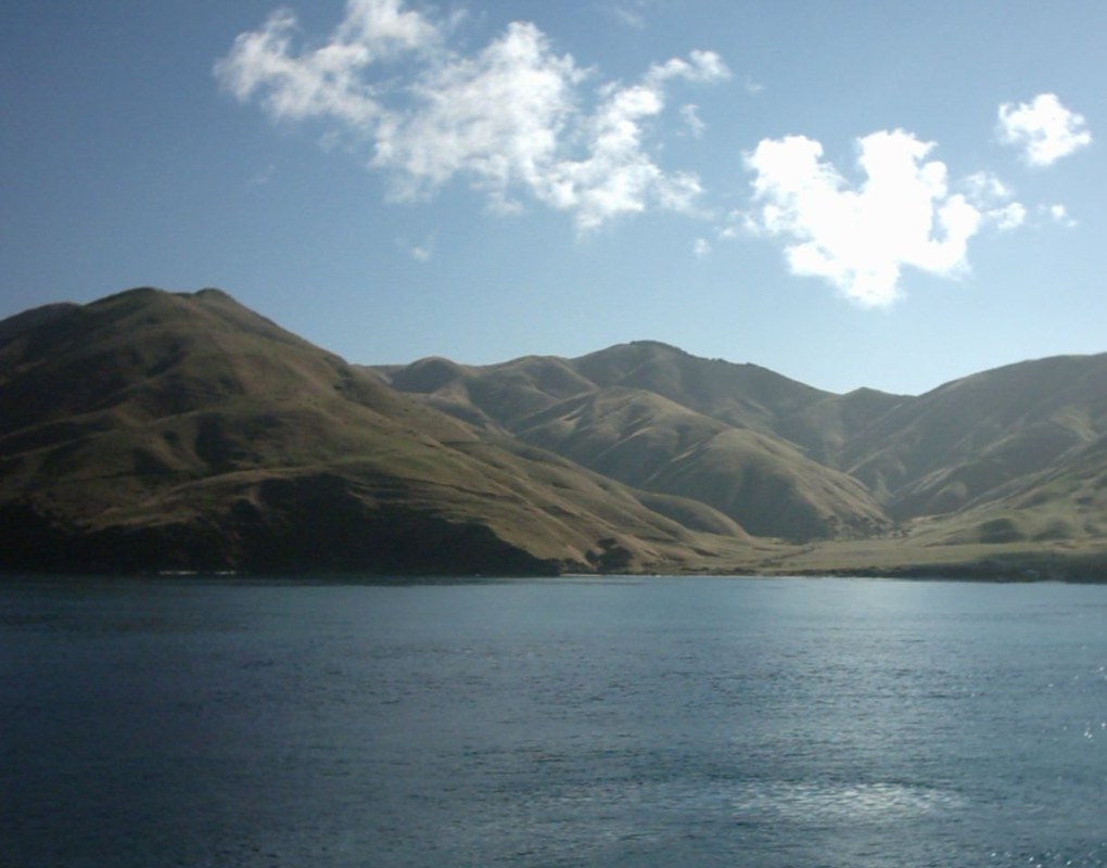
Beginning in the west, the geography of Otago consists of high alpine mountains. The highest peak in Otago is Mount Aspiring/Tititea, which is on the Main Divide. From the high mountains the rivers discharge into large glacial lakes. In this part of Otago glacial activity - both recent and very old - dominates the landscape, with large 'U' shaped valleys and rivers which have high sediment loads. River flows also vary dramatically, with large flood flows occurring after heavy rain. Lakes Wakatipu, Wanaka, and Hawea form the sources of the Clutha, the largest river (by discharge) in New Zealand. The Clutha flows generally to the southeast through Otago and discharges near Balclutha. The river has been used for hydroelectric power generation, with large dams at Clyde and Roxburgh. The traditional northern boundary of the region, the Waitaki River, is also heavily utilised for hydroelectricity, though the region's current official boundaries put much of that river's catchment in Canterbury. The country's fourth-longest river, the Taieri, also has both its source and outflow in Otago, rising from rough hill country and following a broad horseshoe-shaped path, north, then east, and finally southeast, before reaching the Pacific Ocean. Along its course it forms two notable geographic features — the broad high valley of the Strath-Taieri in its upper reaches, and the fertile Taieri Plains as it approaches the ocean. Travelling east from the mountains, the Central Otago drylands predominate. These are Canterbury-Otago tussock grasslands dominated by the block mountains, upthrust schist mountains. In contrast to Canterbury, where the Northwest winds blow across the plains without interruption, in Otago the block mountains impede and dilute the effects of the Nor'wester. The main Central Otago centres, such as Alexandra and Cromwell, are found in the intermontane basins between the block mountains. The schist bedrock influence extends to the eastern part of Otago, where remnant volcanics mark its edge. The remains of the most spectacular of these are the Miocene volcanics centred on Otago Harbour. Elsewhere, basalt outcrops can be found along the coast and at other sites. In the southeastern corner of Otago lies The Catlins, an area of rough hill country which geologically forms part of the Murihiku terrane, an accretion which extends inland through the Hokonui Hills in the Southland region. This itself forms part of a larger system known as the Southland Syncline, which links to similar formations in Nelson (offset by the Alpine Fault) and even in New Caledonia, 3,500 km (2,200 mi) away. The Catlins ranges are strike ridges composed of Triassic and Jurassic sandstones, mudstones and other related sedimentary rocks, often with a high incidence of feldspar. Fossils of the late and middle Triassic Warepan and Kaihikuan stages are found in the area. Weather conditions vary enormously across Otago, but can be broken into two broad types: the coastal climate of the coastal regions and the more continental climate of the interior. Coastal regions of Otago are subject to the alternating warm and dry/cool and wet weather patterns common to the interannual Southern oscillation. The Southern Hemisphere storm track produces an irregular short cycle of weather which repeats roughly every week, with three or four days of fine weather followed by three or four days of cooler, damp conditions. Drier conditions are often the result of the northwesterly föhn wind, which dries as it crosses the Southern Alps. Wetter air is the result of approaching low-pressure systems which sweep fronts over the country from the southwest. A common variant in this pattern is the centring of a stationary low-pressure zone to the southeast of the country, resulting in long-lasting cool, wet conditions. These have been responsible for several notable historical floods, such as the "hundred year floods" of October 1878 and October 1978. Typically, winters are cool and wet in the extreme south areas and Snow can fall and settle to sea level in winter, especially in the hills and plains of South Otago. More Central and Northern Coastal areas winter is sunnier and drier. Summers, by contrast, tend to be warm and dry, with temperatures often reaching the high 20s and low 30s Celsius. In Central Otago cold frosty winters are succeeded by hot dry summers. Central Otago's climate is the closest approximation to a continental climate anywhere in New Zealand. This climate is part of the reason why Central Otago vineyards are successful growing is this region. This inland region is one of the driest regions in the country, sheltered from prevailing rain-bearing weather conditions by the high mountains to the west and hills of the south. Summers can be hot, with temperatures often approaching or exceeding 30 degrees Celsius; winters, by contrast, are often bitterly cold - the township of Ranfurly in Central Otago holds the New Zealand record for lowest temperature with a reading of -25.6 °C on 18 July 1903.

Southland

Southland is New Zealand's southernmost region. It consists mainly of the southwestern portion of the South Island and Stewart Island / Rakiura. It includes Southland District, Gore District and the city of Invercargill. The region covers over 3.1 million hectares and spans over 3,400 km of coast. Southland was a scene of early extended contact between Europeans and Maori, in this case sealers, whalers and missionaries – Wohlers at Ruapuke. In 1853, Walter Mantell purchased Murihiku from local Maori iwi, claiming the land for European settlement. Over successive decades, present-day Southland and Otago were settled by large numbers of Scottish settlers. Immigration to New Zealand had been precipitated by an economic depression in Scotland and a schism between the Church of Scotland and the Free Church of Scotland. In 1852, James Menzies, leader of the Southland separatist movement, became the first Superintendent of the tiny Southland electorate which was still part of the large Otago Region. Under the influence of Menzies, Southland Province (a small part of the present Region, centred on Invercargill) seceded from Otago in 1861 following the escalation of political tensions. However, rising debt forced Southland to rejoin Otago in 1870, and the province was abolished entirely when the Abolition of the Provinces Act came into force on 1 November 1876. In the 1880s, the development of an export industry based on butter and cheese encouraged the growth of dairy farming in Southland. Consequently, the colony's first dairy factory was established at Edendale in 1882. Much of this export went to the United Kingdom. The region's largest flood on 27 January 1984 led to a state of emergency being declared, evacuation of 4,000 people, and damage exceeding $100 million (in 1984 dollars).

Greater Wellington

Greater Wellington is a local government region of New Zealand that occupies the southern end of the North Island. The region covers an area of 8,049 square kilometres , and is home to a population of 496,900 . The region is named for Wellington, New Zealand's capital city and region's seat. The Wellington urban area, including the cities of Wellington, Porirua, Lower Hutt and Upper Hutt, accounts for 80 percent of the region's population; Other major urban areas include the Kapi1ti conurbation of Waikanae, Paraparaumu, Raumati and Paekakariki, and the town of Masterton. In common usage the terms Wellington region and Greater Wellington are not clearly defined, and areas on the periphery of the region are often excluded. In its more restrictive sense the region refers to the cluster of built-up areas west of the Tararua ranges. The much more sparsely populated area to the east has its own name, Wairarapa, and a centre in Masterton. To a lesser extent, the Kapiti Coast is sometimes excluded from the region. Otaki in particular has strong connections to the Horowhenua District to the north. Wellington City mayor Celia Wade-Brown is not in favour of the region adopting a 'super city' type council like the one in Auckland, though is in favour of reducing the number of councils from nine to "three or four". The Māori who originally settled the region knew it as Te Upoko o te Ika a Māui, meaning "the head of Māui's fish". Legend recounts that Kupe discovered and explored the region in about the tenth century. The region was settled by Europeans in 1839 by the New Zealand Company. Wellington became the capital of Wellington Province upon the creation of the province in 1853, until the Abolition of the Provinces Act came into force on 1 Nov 1876. Wellington became capital of New Zealand in 1865, the third capital after Russell and Auckland. The region occupies the southern tip of the North Island, bounded to the west, south and east by the sea. To the west lies the Tasman Sea and to the east the Pacific Ocean, the two seas joined by the narrow and turbulent Cook Strait, which is 28 kilometres wide at its narrowest point, between Cape Terawhiti and Perano Head in the Marlborough Sounds. The region covers 7,860 square kilometres , and extends north to Otaki and almost to Eketahuna in the east. Physically and topologically the region has four areas running roughly parallel along a northeast–southwest axis: The Kapiti Coast, a narrow strip of coastal plain running north from Paekakariki. It contains numerous small towns, many of which gain at least a proportion of their wealth from tourism, largely due to their fine beaches. Rough hill country inland from the Kapiti Coast, formed along the same major geologic fault responsible for the Southern Alps in the South Island. Though nowhere near as mountainous as the alps, the Rimutaka and Tararua ranges are still hard country and support only small populations, although it is in small coastal valleys and plains at the southern end of these ranges that the cities of Wellington and the Hutt Valley are located. The undulating hill country of the Wairarapa around the Ruamahanga River, which becomes lower and flatter in the south and terminates in the wetlands around Lake Wairarapa and contains much rich farmland. Rough hill country, lower than the Tararua Range but far less economic than the land around the Ruamahanga River. This and the other hilly striation are still largely forested.

West Coast

The West Coast is a region of New Zealand on the west coast of the South Island, one of the more remote and most sparsely populated areas of the country. It is administered by the West Coast Regional Council. At the territorial authority level, the region comprises Buller District, Grey District and Westland District. The principal towns are Westport, Greymouth and Hokitika. The region reaches from Kahurangi Point in the north to Awarua Point in the south, a distance of 600 km. To the west is the Tasman Sea (which like the Southern Ocean can be very rough, with four-metre swells common), and to the east are the Southern Alps. Much of the land is rugged, with a coastal plain where much of the population resides. The land is very scenic, with wild coastlines, mountains and a very high proportion of native bush, much of it native temperate rain forest. It is the only part of New Zealand where significant tracts of lowland forest remain: elsewhere, for instance on the Canterbury Plains and in the Firth of Thames, they have been almost completely destroyed for settlement and agriculture. Scenic areas include the Haast Pass, Fox and Franz Josef Glaciers, the Pancake Rocks at Punakaiki and the Heaphy Track. The region has a very high rainfall due to the prevailing northwesterly wind pattern and the location of the Southern Alps, which give rise to heavy orographic precipitation. The rain shadow effect is responsible for the relatively arid climate of the Canterbury Plains on the other side of the Southern Alps. The region's area is 23,276 km2. It is divided into the three districts of Buller, Grey and Westland. Industries on the West Coast include mining for coal and alluvial gold, forestry and wood processing, and also fishing (including whitebaiting), tourism and farming. Dairy farming has grown strongly - the local dairy co-operatives Westland Milk Products remained independent when most others merged to form Fonterra in 2001. Other industries are the manufacturing and sales of greenstone jewellery, sphagnum moss gathering and stone-collection for garden landscaping. The sub-national GDP of the region was estimated at US$779 million in 2003, 1% of national GDP. The region is home to Māori, who valued it for the greenstone (pounamu) found there in abundance. The region was only occasionally visited by Europeans until the discovery of gold near the Taramakau River in 1864 by two Māori, Ihaia Tainui and Haimona Taukau. By the end of the year there were an estimated 1800 prospectors, many of them around the Hokitika area, which in 1866 was briefly the most populous settlement in New Zealand. The region was divided between Nelson Province and Canterbury Province from 1853: in 1873 the Canterbury portion of the region formed its own province, the Westland Province, until the abolition of the provincial system in 1876. The West Coast Gold Rush between 1864 and 1867 created numerous gold rush towns such as Okarito, which at one time was the largest town on the West Coast but quickly almost vanished as miners moved on. After that time, the population dwindled, but the main towns that still exist had become established. Following greenstone and gold, the next valuable mineral was coal. Discovered near the Buller River in the mid-1840s, mining began in earnest during the 1860s. By the 1880s coal had become the region’s main industry, with mines throughout the northern half of the region, especially around Westport. Many of these continued in operation until the mid-20th century, and several survive.

Tasman Region

Tasman District is a local government district in the north of the South Island of New Zealand. It borders the West Coast Region, Marlborough Region and Nelson City. It is administered by the Tasman District Council, a unitary authority, which sits at Richmond, with community boards serving outlying communities in Motueka and Golden Bay. The city of Nelson has its own unitary authority separate from Tasman District, and both comprise a single region in some contexts, but not local government or resource management. Tasman District is a large area at the western corner of the north end of the South Island of New Zealand. It covers 9,786 square kilometres and is bounded on the west by the Matiri Ranges, Tasman Mountains and the Tasman Sea. To the north Tasman and Golden Bays form its seaward edge, and the eastern boundary extends to the edge of Nelson city, and includes part of the Spencer Mountains and the Saint Arnaud and Richmond Ranges. The Victoria Ranges form Tasman's southern boundary and the district's highest point is Mount Franklin, at 2,340 metres. The landscape is diverse, from large mountainous areas to valleys and plains, and is sliced by such major rivers as the Buller, Motueka, Aorere, Takaka and Wairoa. The limestone-rich area around Mount Owen and Mount Arthur is notable for its extensive cave networks, among them New Zealand's deepest caves at Ellis Basin and Nettlebed. There is abundant bush and bird life, golden sand beaches, the unique 40-kilometre sands of Farewell Spit, and good fishing in the bays and rivers. These assets make the district a popular destination for tourists. Tasman is home to three national parks: Abel Tasman National Park , Nelson Lakes National Park and Kahurangi National Park . The Maruia Falls, 8 kilometres southwest of Murchison were created by the 1929 Murchison earthquake when a slip blocked the original channel. Tasman Bay, the largest indentation in the north coast of the South Island, was named after Dutch seafarer, explorer and merchant Abel Tasman. He was the first European to discover New Zealand on 13 December 1642 while on an expedition for the Dutch East India Company. Tasman Bay passed the name on to the adjoining district, which was formed in 1989 largely from the merger of Waimea and Golden Bay counties.

Canterbury

Canterbury is a region of New Zealand, located in the central-eastern South Island. The region covers an area of 44,508 square kilometres , and is home to a population of 586,500 . The region in its current form was established in 1989 during nationwide local government reforms. The Kaikoura District joined the region in 1992 following the abolition of the Nelson-Marlborough Regional Council. Christchurch, the South Island's largest city and the country's third-largest urban area, is the seat of the region and home to 65 percent of the region's population. Other major towns and cities include Timaru, Ashburton, Rangiora and Rolleston. In 1848, Edward Gibbon Wakefield, a Briton, and John Robert Godley, an Anglo-Irish aristocrat, founded the Canterbury Association to establish an Anglican colony in the South Island. The colony was based upon theories developed by Wakefield while in prison for eloping with a woman not-of-age. Due to ties to the prestigious Oxford University, the Canterbury Association succeeded in raising sufficient funds and recruiting middle-class and upper-class settlers. In April 1850, a preliminary group led by Godley landed at Port Cooper—modern-day Lyttelton Harbour—and established a port, housing and shops in preparation for the main body of settlers. In December 1850, the first wave of 750 settlers arrived at Lyttelton in a fleet of four ships. Following 1850, the province's economy developed with the introduction of sheep farming. The Canterbury region's tussock plains in particular were suitable for extensive sheep farming. Since they were highly valued by settlers for their meat and wool, there were over half a million sheep in the region by the early 1850s. By the 1860s, this figure had risen to three million. During this period, the architect Benjamin Mountfort designed many civic and ecclesiastical buildings in the Gothic Revival style. The Canterbury Province was formed in 1853 following the passing of the New Zealand Constitution Act 1852 from the part of New Munster Province and covered both the east and west coasts of the South Island. The province was abolished, along with other provinces of New Zealand, when the Abolition of the Provinces Act came into force on 1 Nov 1876. The modern Canterbury Region has slightly different boundaries, particularly in the North, where it includes some districts from the old Nelson Province.

Waikato

The Waikato region stretches from Coromandel Peninsula in the north, to the north-eastern slopes of Mount Ruapehu in the south, and spans the North Island from the west coast, through the Waikato and Hauraki to Coromandel Peninsula on the east coast. Broadly, the extent of the region is the Waikato River catchment. Other major catchments are those of the Waihou, Piako, Awakino and Mokau rivers. The region is bounded by Auckland on the north, Bay of Plenty on the east, Hawke's Bay on the south-east, and Manawatu-Wanganui and Taranaki on the south. Waikato Region is the fourth largest region in the country in area and population: It has an area of 25,000 km² and a population of 439,200 . The region encompasses all or part of eleven territorial authorities, the most of any region of New Zealand. It is centred on the Waikato which consists of Waikato District, Matamata-Piako District, Waipa District, South Waikato District and Hamilton City. In descending order of land area the eleven territorial authorities are Taupo District , Waitomo District , Waikato District, Thames-Coromandel District, Otorohanga District, South Waikato District, Matamata-Piako District, Waipa District, Hauraki District, Rotorua District , and Hamilton City. The name for the region is taken from the Waikato River; waikato is a Māori word traditionally translated as "flowing water" (specifically, wai = "water" and kato = "the pull of the river current in the sea"). To the west, the region is bounded by the Tasman Sea. The coastal region is largely rough hill country, known locally as the Hakarimata Range, though it is more gently undulating in the north, closer to the mouth of the Waikato River. The coast is punctured by three large natural harbours: Raglan Harbour, Aotea Harbour, and Kawhia Harbour. The area around Raglan is noted for its volcanic black sand beaches and for its fine surfing conditions at Manu Bay and Ruapuke beach. To the east of the coastal hills lies the broad floodplain of the Waikato River. This region has a wet temperate climate, and the land is largely pastoral farmland created by European settlers draining the extensive natural swamps, although it also contains undrained peat swamp such as the 200km2 peat dome south of Ngatea. It is in the broad undulating Waikato Plains that most of the region's population resides, and the land is intensively farmed with both livestock, mainly dairy cattle but with sheep farming on the hillier west margins, and crops such as maize. The area around Cambridge has many thoroughbred stables. The north of the region around Te Kauwhata produces some of New Zealand's best wines. Dozens of small shallow lakes lie in this area, the largest of which is Lake Waikare. To the east, the land rises towards the forested slopes of the Kaimai and Mamaku Ranges. The upper reaches of the Waikato River are used for hydroelectricity, helped by several large artificial lakes in the region's south-east. The lowest and earliest-created such lake is Lake Karapiro, now developed as a world-class rowing centre, where the world championships were held in 2010. The river flows out of the country's largest lake, Lake Taupo, which is served by several important fishing rivers such as the Tongariro, on the Central Plateau, draining the eastern side of Mount Ruapehu and its neighbours. The climate is mild and temperate with moderate rainfall of 1200–1600mm per annum, with the higher western hills having the most rain. Summers are drier with maximum temperatures of 25–28 degrees Celsius. Summer droughts occur one year in ten. Winter maxima are 12–15 degrees Celsius. The lower areas experience regular morning fog, under anticyclonic conditions, which burns off by late morning to produce many still, clear sunny days. Morning frosts are also common during winter anticyclones. Another distinctive feature is the low average wind speed in the interior basin due to the sheltering influence of the hills and mountains to the west and south-west. The prevailing winter wind is from the south-west. The Waikato has very high sunshine hours by world standards, averaging 2200 hours per year or about 40% higher than in the UK. This results in rapid growth of grass, crops and ornamental plants.

Taranaki

Taranaki is a region in the west of New Zealand's North Island, administered by the Taranaki Regional Council. It is named for its main geographical feature, the stratovolcano of Mount Taranaki. The main centre is the city of New Plymouth. The New Plymouth District has over 65% of the population of Taranaki. New Plymouth is in North Taranaki along with Inglewood and Waitara. South Taranaki towns include Hawera, Stratford and Eltham. Since 2005, Taranaki has used the promotional brand "Like no other". Taranaki is on the west coast of the North Island, surrounding the volcanic peak. The region has an area of 7258 km². The large bays north-west and south-west of Cape Egmont are the prosaically named North Taranaki Bight and South Taranaki Bight. Mount Taranaki or Mount Egmont, the second highest mountain in the North Island, is the dominant feature of the region. A Māori legend says that Taranaki previously lived with the Tongariro, Ngauruhoe and Ruapehu mountains of the central North Island but fled to its current location after a battle with Tongariro. A near-perfect cone, it last erupted in the mid-18th century. The mountain and its immediate surrounds form Egmont National Park. Māori had called the mountain Taranaki for many centuries, and Captain James Cook renamed it Egmont after the Earl of Egmont, the recently retired First Lord of the Admiralty who had encouraged his expedition. The mountain has two alternative official names, "Mount Taranaki" and "Mount Egmont". The region is exceptionally fertile, thanks to generous rainfall and the rich volcanic soil. Dairy farming predominates, with Fonterra's Whareroa milk factory just outside of Hawera producing the largest volume of dairy ingredients from a single factory anywhere in the world. There are also oil and gas deposits in the region, both on- and off-shore. The Maui gas field off the south-west coast has provided most of New Zealand's gas supply as well as, at one time supporting two methanol plants (one formerly a synthetic-petrol plant called the Gas-To-Gasoline plant) at Motunui. More fuel and fertiliser is produced from a well-complex at Kapuni and a number of smaller land-based oilfields. With the Maui field nearing depletion, new offshore resources have been developed: The Tui field, 50 km south of Hawera, with reserves of 50,000,000 barrels (7,900,000 m3) of oil and the Pohokura gas field, 4.5 km north of Waitara. The way the land mass projects into the Tasman Sea with northerly, westerly and southerly exposures results in many excellent surfing and windsurfing locations, some of them considered world-class.

Bay of Plenty

The Bay of Plenty , often abbreviated to BOP, is a region in the North Island of New Zealand situated around the body of water of the same name. The bay was named by James Cook after he noticed the abundant food supplies at several Māori villages there, in stark contrast to the earlier observations he had made in Poverty Bay. In the 2006 Census, the Bay of Plenty had an estimated resident population of 257,379, making it the fifth-most populous region in New Zealand. It also has the third-highest regional population density in New Zealand, with only the 11th-largest land area. The major population centres are Tauranga, Rotorua and Whakatane. The Bay of Plenty is one of the fastest growing regions in New Zealand: the regional population increased by 7.5% between 2001 to 2006, with significant growth along the coastal and western parts, and is projected to increase to 277,900 by the year 2011. Significant horticultural, forestry and tourism industries are well established in the region. However, the Bay of Plenty is the third-most economically deprived region in New Zealand, with the eastern districts being among the least economically developed in the country. However, in 2011 Business & Economic Research Limited identified the Bay of Plenty as one of the top performing regions in economic development, ranking second behind Auckland. It had the highest employment and GDP growth for 2011 and had the fastest growing medium term GDP. Tauranga, the region's largest commercial centre, was named New Zealand's top city for economic performance for the 2011 year. According to local Māori traditions, the Bay of Plenty was the landing point of several migration canoes that brought Māori settlers to New Zealand. These include the Mataatua, Nukutere, Tākitimu, Arawa and Tainui canoes. Many of the descendent iwi maintain their traditional homelands in the region, including Te Whānau-ā-Apanui, Te Whakatōhea, Ngāi Tai, Ngāi Tūhoe, Ngāti Awa, Ngāti Tūwharetoa ki Kawerau, Te Arawa, Ngāi Te Rangi, Ngāti Ranginui and Ngāti Pūkenga. Early Māori settlement gave rise to many of the town and city names used today. The first recorded European contact came when James Cook sailed through the Bay of Plenty in 1769. Cook noted the abundance of food supplies, in comparison to Poverty Bay further back along the eastern coast of the North Island. Further reports of European contact are scarce prior to the arrival of missionary Samuel Marsden to the Tauranga area in 1820. During the 1820s and 1830s, northern iwi including Ngā Puhi invaded the Bay of Plenty during their campaign throughout the North Island, fighting local Māori tribes in what became known as the Musket Wars. However, the 1830s and 1840s saw increased contact between Bay of Plenty Māori and Europeans through trade, although few Europeans settled in the region. Missionary activity in the region also increased during this time. In 1853, New Zealand was subdivided into provinces, with the Bay of Plenty incorporated into Auckland Province. Conflict returned to the Bay of Plenty during the 1860s with the New Zealand Land Wars. Initial conflicts in the region stemmed from Tauranga iwi supporting the Waikato iwi in their conflict with the government. In retaliation, British Crown and government-allied Māori forces attacked the Tauranga iwi, including at the famous Battle of Gate Pā in 1864. Further conflict with the government arose in 1865 when German missionary Carl Völkner and interpreter James Fulloon were killed by local Māori at Opotiki and Whakatane, respectively. The ensuing conflict resulted in the confiscation of considerable land from several Bay of Plenty iwi by the government. Confiscation of Māori land deprived local iwi of economic resources , and also provided land for expanding European settlement. The government established fortified positions, including at Tauranga, Whakatane and Opotiki. European settlers arrived throughout the latter half of the 19th century, establishing settlements in Katikati, Te Puke and the Rangitaiki area. In 1876, settlements were incorporated into counties following the nationwide dissolution of the provincial system. Initial settlements in the region struggled: the climate was ill-suited to sheep farming and the geography was inaccessible, further hindered by a lack of infrastructure. By the end of the century the population had started to dwindle. But after experimenting with different crops, settlers found success with dairy production. Dairy factories sprang up across the Bay of Plenty in the 1900s, with butter and cheese feeding economic prosperity throughout the early 20th century; local Māori continued to live on the fringe of this prosperity. Timber also became a major export in the 1950s, as kiwifruit did later. The present Bay of Plenty region was formed in 1989 after a nationwide review and shakeup of top-level local government in New Zealand. The new region incorporated the former counties of Tauranga, Rotorua, Whakatane and Opotiki.

Gisborne Region

The Gisborne District or Gisborne Region is an area of northeastern New Zealand governed by the Gisborne District Council. It is named after its largest settlement, the city of Gisborne. It is also known as the East Coast region, although it is often divided into the East Coast proper, also known as East Cape, north of the city, and Poverty Bay, the area including and surrounding the city. The region is also sometimes referred to as the East Cape, although that also refers specifically to the promontory at the northeastern extremity. More recently, it has been called Eastland, although that can also include Opotiki in the eastern Bay of Plenty to the northwest, and Wairoa to the south. Its Māori name, Te Tai Rāwhiti, means the Coast of the Sunrise, reflecting the fact that it is the first part of the New Zealand mainland to see the sun rise. == Geography == The district is located in the northeastern corner of the North Island. It ranges from the Wharerata Hills in the south, which divide it from the Wairoa district in the Hawke's Bay region, to Lottin Point in the north. The western boundary runs along the Raukumara Range, which separates it from the Opotiki district. In the southwest, its boundary runs along the western edge of Te Urewera National Park. It is sparsely inhabited and isolated, with small settlements mainly clinging to small bays along the eastern shore including Tokomaru Bay and Tolaga Bay. Its population is 47,400 . Three-quarters of the population – 35,700 – lives in the city of Gisborne. No other settlement has a population of over 1000. The largest other settlements are the towns of Tolaga Bay and Ruatoria, each with populations of over 800 in 2001. Inland, the land is rough, predominantly forested, hill country. A spine of rough ridges dominates the centre of the region, culminating in the impressive bulk of the 1752 metre Mount Hikurangi in Waiapu Valley in the region's northeast. This mountain is the fifth highest mountain in the North Island, and the highest that is not a volcano. Regarded as sacred by the Māori, there is some justification to the claims that this is the first mountain to see the sun in summer. The region's population has higher than the national average proportion of Māori - over 50% in some areas - and still maintains strong ties to both Māori tradition and the iwi and marae structure. The predominant iwi are Ngāti Porou, Rongowhakaata, Ngai Tamanuhiri, Te Aitanga a Mahaki. == Government == Gisborne District Council is a unitary territorial authority, which means that it performs the functions of a regional council as well as those of a territorial authority . It includes a mayor, 14 elected councillors, an appointed chief executive officer, 4 department managers and approximately 250 staff. Its headquarters are in the city of Gisborne. The area it governs is constituted as both the Gisborne District and the Gisborne Region. Gisborne District Council was created as part of a major nationwide reform of local government in 1989. It replaced the councils of Gisborne City, Cook County, Waiapu County and Waikohu County, East Cape United Council, East Cape Catchment Board and Regional Water Board, East Coast Pest Destruction Board, two harbour boards, and several noxious plants authorities and recreation reserve boards. It was the only unitary authority in New Zealand until three others were created in 1992. == Economy == The sub-national GDP of the Gisborne region was estimated at US$1.031 billion in 2003, 1% of New Zealand's national GDP. == Climate == The region is sheltered by high country to the west and has a dry, sunny climate. It has a yearly average of 2,200 sunshine hours. The annual rainfall varies from about 1000mm near the coast to over 2500mm in higher inland country. == Demographics == Gisborne District had a population of 43,656 according to the 2013 census. This is a decrease of 807, or 1.8 percent, since the 2006 census. There were 16,185 occupied dwellings, 1,824 unoccupied dwellings, and 51 dwellings under construction. Of the residential population, 21,093 were male compared to 48.7% nationally, and 22,560 were female, compared to 51.3% nationally. The city had a median age of 37.0 years, 1.0 years below the national median age of 38.0 years. People aged 65 and over made up 14.0% of the population, compared to 14.3% nationally, and people under 15 years made up 24.6%, compared to 20.4% nationally. People aged between 15 and 24 made up approximately 12.7% of the city's residential population. Gisborne's ethnicity is made up of (national figures in brackets): 56.1% European (74.0%), 45.1% Māori (14.9%), 2.2% Asian (11.8%), 3.5% Pacific Islanders (7.4%), 0.4% Middle Eastern, Latin American or African (1.2%), 1.4% 'New Zealanders' (1.6%), and 0.05% Other (0.1%). Gisborne had an unemployment rate of 9.4% of people 15 years and over, compared to 7.4% nationally. The median annual income of all people 15 years and over was $24,400, compared to $28,500 nationally. Of those, 41.9% earned under $20,000, compared to 38.2% nationally, while 19.6% earned over $50,000, compared to 26.7% nationally. Gisborne has the smallest percentage of population born overseas at 9.7% compared to 25.2% for New Zealand as a whole. The highest of these are British totalling 1,335 or 3.1% of the population. Furthermore, 73.0% of the population could speak in one language only, 16.2% in two languages and 1.1% in three or more languages. == 2007 earthquake == At 8.55pm (NZDT) on 20 December 2007, the Gisborne region was hit by an earthquake of Richter magnitude 6.8, centred in the Hikurangi Trench, 50 km southeast of Gisborne at a depth of 40 km. Mercalli intensities of 7-8 were experienced, with three buildings substantially collapsed in the CBD and others experiencing some structural damage. One death was reported (a heart attack of an elderly woman, sustained during the quake) plus minor injuries. == Sport == The district is represented in rugby union by the East Coast Rugby Football Union and the Poverty Bay Rugby Football Union. == See also == 2006 Tonga earthquake List of marae in the Gisborne District List of schools in the Gisborne District

Hawke's Bay

Hawke's Bay Region is situated on the east coast of the North Island. It bears the former name of what is now Hawke Bay, a large semi-circular bay that extends for 100 kilometres from northeast to southwest from Mahia Peninsula to Cape Kidnappers. The Hawke's Bay region includes the hilly coastal land around the northern and central bay, the floodplains of the Wairoa River in the north, the wide fertile Heretaunga Plains around Hastings in the south, and a hilly interior stretching up into the Kaweka and Ruahine Ranges. Five major rivers flow down into the coast of Hawke's Bay. From north to south, they are the Wairoa River, Mohaka River, Tutaekuri River, Ngaruroro River and Tukituki River respectively. Lake Waikaremoana is situated in northern Hawke's Bay roughly 35 km from the coast. It is the largest lake in Hawke's Bay, 4th largest in the North Island and 16th largest in New Zealand. The region consists of Wairoa District, Hastings District, Napier City, and its southernmost district, Central Hawke's Bay District, as well as the town of Taharua in Taupo District and the town of Ngamatea in Rangitikei District. It does not include Southern Hawke's Bay, whose constituent districts, the Dannevirke and Woodville counties, came under the Tararua District Council and the Manawatu-Wanganui Regional Council (also known as Horizons Regional Council) in the 1989 local government reforms. In June 2015, the Local Government Commission proposed the amalgamation of the four local councils with the Hawke's Bay Regional Council. The region has a hill with the longest place name in New Zealand, and the longest in the world according to the 2009 Guinness Book of Records. Taumata­whakatangihanga­koauau­o­tamatea­turi­pukakapiki­maunga­horo­nuku­pokai­whenua­kitanatahu is an otherwise unremarkable hill in southern Hawke's Bay, not far from Waipukurau. The region has a significant Māori population; 24.3 percent of the population identified as of Māori ethnicity at the 2013 census. A major local Māori tribe is Ngāti Kahungunu. Around 50.5 percent of Hawke's Bay's population affiliate with Christianity at the 2013 Census, making it one of two regions in New Zealand (the other being Southland) with a majority Christian population. Hawke's Bay Province was founded in 1858 as a province of New Zealand, after being separated from the Wellington Province following a meeting in Napier in February 1858. The Province was abolished in 1876 along with all other provinces in New Zealand. It was replaced with a Provincial District. On February 3, 1931, Napier and Hastings were devastated by New Zealand's worst natural disaster, an earthquake measuring 7.9 on the Richter magnitude scale, which killed 256 people. Napier rebuilt and now the city is world famous for its Art Deco buildings, and celebrates its heritage each February with the Art Deco Weekend. MTG Hawke's Bay, formerly Hawke's Bay Museum and Art Gallery, has an exhibition on the earthquake, its causes and impact.

This attraction is located in

This is a private property. Please enjoy respectfully and do not disturb the occupants.

Edit Categories
Add Tours

This attraction is not part of any tours

Add Collections

This attraction is not part of any collections


Some of the attractions we imported from Wikipedia are not perfect. Send us an email detailing what's wrong and we'll look into fixing it.

GuRoute is all about Gurus sharing their local knowledge. If you feel up to fixing this problem yourself, why not adopt it. You will become the owner and can fix whatever problems you see.

We've copied a link to this attraction into your clipboard so that ou can paste it into an email or text message...

More Info...
You can add your friends to the visit yourself, or, send them a link and let them add themselves...

The visit will appear on both your timelines and on your Shared Timeline.

Click below and we'll email you a link that you can send on to friends or post on your group's Facebook page.

If your friends aren't members of GuRoute yet, this is a great way to get them started.
Recent
Recently used Collections will appear here...
Recent
Recently used tours will appear here...

Where is this?

GuRoute likes to place attractions inside other attractions. So, maybe it's in a city, or maybe it's inside a particular park in that city. Maybe your attraction is a huge park that spans half the county, or multiple counties.

Determining where this attraction is gives it context - if it's in a park, you'll be able to see it alongside all the other attractions in that park. And that helps define the park.

GuRoute will automatically calculate a parent region for this attraction. You can change it if there is something more appropriate.

This attraction is currently located in .

Change

This attraction does not yet have any reviews

Please login to write a review...

Reviewed by
Record new Visit

Add this location to your timneline?

  • If there's an existing attraction open it and add it to your timeline...
  • If not, enter a title and we'll create a new attraction for your memories...
Create new Attraction

Create a new attraction at this location?

  • We rely on Gurus like you to share your local knowledge...
(Give a name for this location)


+
Add this to your timeline instead...

Imagine having a record of all the cool things you've done in your life!


Using our timeline you can keep track of everywhere you visit in your lifetime...

But, you'll need to sign in first...

Add contacts so that you can share your travels and record places that you visit together...

Family
Favorites
Family
Favorites

Profile TimeLine Our Visits Edit Accept Decline Invite

If you have any more friends that visited this place with you, feel free to add them to the visit. We'll write it to their timeline and once they confirm it, they too will have this memory for a lifetime.

If they're not already registered, you just need their name and email address and you can add them and we'll send them an invite on your behlaf.

Add a tour comment

Add some extra information for when this attraction is viewed as part of your tour...

Next Stop Instructions

Add some instructions for what to see/do on the way to the next stop...

Next Stop Instructions

Add some instructions for what to see/do on the way to the next stop...

If you're visiting an existing attraction, open it and add it to your timeline. If there is no attraction for the place you are visiting...

  • Click 'Add My Location' below
  • Or right-click on the map to mark a different location
  • Or long-press if you have a touch screen
You can even add locations while you're offline....
  • Load up the map when you're online and we'll keep track of your locaiton
  • You can add locations to your timeline
  • When you are online again we'll sync them with the cloud

We can't connect to the internet right now. The following attractions are saved locally and can be uploaded when you're online...

GuRoute would like to access your current location so that we can pin you on the map and show you nearby attractions

Add friends so that you can share your experiences with each other...

Add tour to What's Next?

Go...

Either for yourself or someone else...

  1. Do your trip research in GuRoute
    Add all the places that you think might be worthy of a visit into a trip-plan
  2. Add your trip-plan to your "What's Next" timeline
    (or a friend's "What's Next" timeline)
  3. When you're on vacation you'll have all your research at your fingertips
  4. Share your timline with your friends
    They can enjoy your vacation with you, seeing not only where you've been, but where you're going next...
  5. Add/remove attractions if things change

It also makes a great souvenir of your trip

Collections

Go...

Create a home page for a collection of attractions

  • Add an image and description to display on the homepage
  • Start adding content
    Add existing attractions to your collection or create new attractions of your own
  • Collections can be:
    • Public (Anyone can add attractions to your collection)
    • Shared (Only yourself and Gurus you nominate can add content)
    • Private (The collection will only be visible to yourself)

Uses

  • Local business or hotel
    Showcase local attractions that you endorse
  • Clubs
    Showcase attractions that members have created (eg. local historical society)
  • Special Interest
    If GuRoute does not have a category for your special interest you add your attractions to your own collection instead

Examples

Walking/Driving Tours

Go...

A guided tour where GuRoute will direct you from stop to stop and narrate a description of each attraction you arrive at

  • GuRoute uses your phone's GPS to guide you from stop to stop
  • GuRoute automatically detects when you arrive at the next tour-stop and narrates the description of the attraction (Chrome Only)
  • It then sends you on to the next stop

Tours are great to attract people to your town. Even places with no significant points of interest can be lots of fun when part of a tour


Cater tours to your Audience

  • Kid-friendly Tours
    • Focus on what will keep kids interested
    • Instead of parents having to drag their kids around they'll be struggling to keep up
    • Let the kids navigate and they'll get more fun out of finding that historical plaque than they ever would from reading it
  • Accessible tours
  • Short and long tours of the same location

What you need to do...

  1. Click 'Go...'
    Enter a title, description and location for the tour
  2. Add existing attractions OR create new ones and add them to the tour
  3. For existing attractions you can add more information specific to the theme of the tour
  4. You can also add instructions on what to do or see en-route to the next tour-stop
  5. Try out your tour and see how it works...

Mystery Tour

Go...

Create a Mystery Tour

Create a series of clues to show people around a city, neighborhood or whatever place you like...

  • GuRoute will show people clues to get them from attraction to attraction
  • When they reach each stop GuRoute will tell them about the place and give them the next clue
  • Take as long or as you like and explore each location at your leisure

Scavenger Hunt

Go...

Create a Scavenger Hunt

Create a series of questions that people have to answer. The answers can all be discovered by walking aroung the area, looking for clues.

  • How many beers are on tap at Michael Collin's Irish Bar?
  • What's the name of the oldest building on main streeet?
  • Show a picture of some public art and ask them what it is called
  • Clues can have numeric or multiple choice answers