Sign In

My Timeline

GuRoute

Discover Your World

Share your Experiences

Record your Life


Top Attractions in Tonga

Nuku‘alofa

Nukuʻalofa is the capital of the Kingdom of Tonga. It is located on the north coast of the island of Tongatapu, in the southernmost island group of Tonga. In the Tongan myth of the origin of Nukuʻalofa, it was said that the meaning of Nukuʻalofa is: nuku meaning abode, ʻalofa meaning love. The name is said to have originated when Moʻungatonga, the 6th Tuʻi Haʻatakalaua (King who governs the daily business of Tonga on behalf of the Tuʻi Tonga or Sacred King of Tonga) sent his youngest son, Ngata (later to be 1st Tuʻi Kanokupolu) as governor to Hihifo (Western side of Tongatapu). It was a difficult decision for Ngata as the Tu’i Tonga and Tu’i Ha’atakalaua have been unable to control Hihifo. Ngata had many reasons to fear for his life as his predecessors had been killed by the chiefs and people of Hihifo. When Ngata left Muʻa, the old capital and residence of the Tuʻi Tonga and Tuʻi Ha'atakalaua, he was escorted by Nuku (an uncle) and Niukapu (an older cousin), chiefly relatives of his father. They sailed their canoes with all their followers from Muʻa and debated abandoning Tonga and sailing directly to Samoa, the homeland of Ngata’s mother. It was decided not to abandon Tonga, but to pull their canoes up into the swamp area halfway between Muʻa and Hihifo in order to plan and prepare for their landing at Hihifo. Ngata, Nuku and Niukapu decided to wrap their combined bodies under a large mat and land in Hihifo, giving the impression of a large man with three heads. This is the origin of the ʻUlutolu (Three Head Story) and of the Haʻa Tuʻi Kanokupolu, third lineage King of Tonga. They named the swampy area as Nuku (Abode) ʻAlofa (Love) or the Abode of Love, thus Nukuʻalofa. On 10 June 1777, British captain James Cook wrote of his arrival at their anchorage place. His description of the place confirmed, with his map, that this was the bay of Nukuʻalofa. At length, about two in the afternoon, we arrived at our intended station. It was a very snug place, formed by the shore of Tongataboo on the South East, and two small islands on the East and North East. Here we anchored in ten fathoms water, over a bottom of oozy sand; distant from the shore one-third of a mile [500 m]." Cook never used the name Nukualofa or any other spelling for the reports of this voyage, but he mentioned the island of Pangaimodoo (Pangaimotu) which was to the east of his anchorage position. Captain Cook also wrote that he travelled by canoes to visit Mooa (Muʻa) where Paulaho and other great men lived. The house that Paulaho provided was on the beach 500 metres (1⁄3 mi) from the ship. Reference to his map shows that he must have landed and stayed in the Siesia area, the eastern part of modern Nukuʻalofa. Cook also drafted the first map of the bay of Nuku'alofa. The first written record for Nuku'alofa is stated in the first dedicated book for Tonga by George Vason which was published in 1810. George Vason was an English missionary from the London Missionary Society, who arrived in Tonga in 1797. George Vason wrote of their arrival that: Before we could well come to an anchor, the ship was surrounded by the natives, who flocked to us from every adjacent Island. The place, before which we anchored, was called Noogollefa: it was near an Island, named Bonghy-moddoo; on which former navigators pitched their tents, as a convenient spot, on account of its separation from the main Island, to preserve themselves from being too much incommoded by the natives. That was the first mention of Nuku'alofa, spelled as Noogoollefa. Pangaimotu was spelled as Bongy-Moddoo by George Vason since Tongan writing and alphabet would be developed in 1826-27. The second oldest book dedicated to Tonga was by William Mariner, adopted son of Finau 'Ulukalala, which was published in 1817. Mariner described his experiences during the years he was the adopted son of 'Ulukalala (1806–1810). He described the civil war and the siege of the Fort of Nuku'alofa, which fell to 'Ulukalala and his warriors. The third attempt of Christian missionaries were recorded in April 1826, when two Tahitian London Missionaries were detained by Tupou the chief of Nuku'alofa. In March 1826, the four men left Tahiti in the Minerva, their destination Fiji. But at Nuku’alofa, Tonga, their plans were disrupted by the high chief Tupou (Aleamotu’a). From Davies’ perspective the Tahitian were placed under detention at Tongatapu: “The chief called Tupou would not let them proceed. He had been himself a resident in Lageba and calls himself the friend of Tuineau, the chief of Lageba and as such he took possession of the present intended for the Fijian chief. The arrival of the Methodist missionaries in Nuku'alofa in 1827 reinforced the Christian faith. The persecution suffered by Christians in Hihifo and Hahake forced a lot of people to seek refugees in Nuku'alofa. Thanks to the encouragement of Tupou, the King of Nuku'alofa, this was the beginning of the expanding of Nuku'alofa to become the major center of Christianity in Tonga. The final phase of the arrival of Christianity in Tonga was the arrival of Father Chevron, or Patele Sevelo, in 1842. He wrote that he arrived in Nuku'alofa in 1842 and met the Tu'i Kanokupolu Aleamotu'a who was baptised by the Wesleyan as Sosaia." In conclusion, these arrival turned Nuku'alofa from a small village and fort into the center of Tonga during the arrival of Christianity. From the earliest record for Nuku'alofa, the early writer always refer to the settlement as Noogollefa (1797), Nioocalofa (1806), Nukualofa (1826 by Methodist) and Noukou-Alofa (1842 by French Catholic Priest). There was no other mention of any other name of the settlement but only of the settlement or fort of Nuku'alofa. 
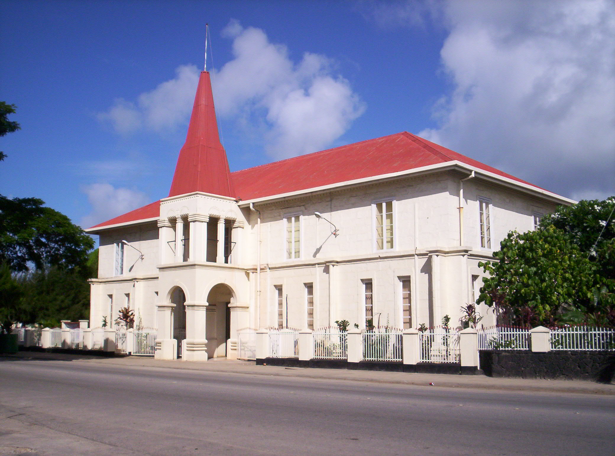
The Declaration of the Constitution of Tonga in 1875 formalised Nuku'alofa as the Capital of Tonga. King George Taufa'ahau Tupou I issued the Constitution of Tonga on 4 November 1875, in Nuku'alofa. The Constitution also stated (Article 38) that the Parliament will meet in Nuku'alofa except in time of war. Since Nuku'alofa have been expanding from when it became the center of Christianity in Tonga in the 19th century, it became essential that it was reorganised for effective administration of the capital. The reorganisation of Nuku'alofa divided up Nuku'alofa into three major district areas: Kolomotu'a (Kolo meaning "town" or "settlement", motu'a meaning "old"), encompassing the city's original settlement at the old fort of Nukualofa, including the area of Tavatu'utolu (Longolongo), Sopu 'o Vave (now Sopu 'o Taufa'ahau), Tongata'eapa, Tufuenga, Kapeta and all the western area where it was the traditional settlement of the Tu'i Kanokupolu from Mumui the 13th Tu'i Kanokupolu to Aleamotu'a the 18th Tu'i Kanokupolu. Kolofo'ou (fo'ou meaning "new"). This area started from the Vaha'akolo Road and all the eastern side to Ma'ufanga which include the Palace of King George Taufa'ahau Tupou I and seat of Government, as well as all the new settlement of Fasi moe Afi 'a Tungi, Malie Taha (One Mile), Ngele'ia was an old settlement during the civil wars and Taufa'ahau and his warriors destroy this settlement. Taufa'ahau settled in his kau To'a Tautahi (Sea-Warlords) in Nuku'alofa for his protection and security from enemies and named the area Kolofo'ou (Newtown or Newsettling). This happened after the burn down and fall of Takai's fortress of Pea in the command of his son Moeakiola in 1852. About the same time Taufa'ahau moved his capital to Kolofo'ou, Nuku'alofa after he ruled and reigned from Pangai, Ha'apai since 1845. Ma'ufanga, on the eastern side of Nuku'alofa. Ma'ufanga was an old village of the Ha'a Takalaua, which is the Estate of the Chief Fakafanua. George Vason mentioned that Ma'ufanga was a refugees area during the civil war, where people could take shelter in time of hardship. Ma'ufanga is the area facing Pangaimotu, where James Cook anchored, and where Paulaho built him a house on the beach, about 500 meters from the ship. The national government is based in Nukuʻalofa. The parliament of Tonga meets there, and the Royal Palace is located near the city.

Haʻamonga ʻa Maui

Haʻamonga ʻa Maui - is a stone trilithon located in Tonga, in the north of the island of Tongatapu, near the village of Niutōua, in Heketā. Trilithon is constructed from three coral limestone slabs, and is up to 5.2 m high, 1.4 m wide, 5.8 m long. The weight of the visible part of each upright stone is approximately 30 - 40 tons. There are hewn deep mortises in the top of each upright stone to fit in the lintel. Ha'amonga 'a Maui was built at the beginning of the 13th century under the 11th Tuʻi Tonga Tuʻitātui , most likely as a gateway to his royal compound Heketā. One can pass through the portal and walk the short distance towards the ʻesi maka faakinanga , which served as the king's throne. Sitting with his back to that stone, he was safe from assassins from behind, and with his long stick he could hit every potential foe from the front on his knees. According to the oral chronicles of Tonga nobleman, trilithon was built to symbolise the brotherhood of the sons of Tuʻitātui - Lafa and Talaihaapepe . The construction works involved large number of people and was done by transporting the stones on wooden slits and placing the stones with the help of earthen inclines and wooden constructions. In popular myths the Haʻamonga is believed to have been made by the demigod Maui, as the stones would be too huge for mortals to handle. The word haʻamonga means: a stick with loads on both ends, carried over the shoulder. Maui was supposed to have the stones obtained from ʻUvea and carried on to Tonga in a giant canoe. In reality the stones are of coral limestone, which structure matches that of old quarries along the neighbouring coasts. The resemblance of the trilithon with Stonehenge is often quoted, but Stonehenge has many more pillars and the lintels are on top of the sarsens, and not sunken down in a slit. Stonehenge may have been an archaeoastronomical observatory, as claimed by Gerald Hawkins in 1963, now largely believed to have been overhyped. Nevertheless, this was enough for the king of Tonga Tāufaʻāhau Tupou IV to come in 1967 with the theory that the Haʻamonga had an astronomical significance too, telling the position of sunrise at solstices and equinoxes. Because he was the king, this account is still quoted nowadays, although any evidence for it is imaginary. In fact there is only one 'proof': According to the roadsign, there is a V shaped mark on the top of the lintel, whose 2 legs point towards the solstice directions, and it is copied on the ground below. Refute: the V on top is an arrow directed along the main axis of the lintel (about ESE, 117°5 E of N), only 10 cm long, too short to be a reliable indicator of any direction. The copy on the ground disappeared before 1990. It was rotated to point in the right directions, though, but with 6 cm size it was even smaller. Some people claim that another V mark was meant. Striations on the top of the stone would be the direction pointers. Refute: The northwest pier had clearly sagged over the centuries, rotating the lintel by about 5°. Any mark supposedly pointing in the right direction now, could never have done so at construction. The striations only match the structure of the stone. A reference to a 19th-century manuscript from Elia Malupō, corrected by the last Tuʻi Tonga, Laufilitonga himself, is sometimes quoted: tuʻu ʻa e Haʻamonga ko e mātanga (the Haʻamonga stands as an observatory). But the daily meaning of the word mātanga is, and always has been, a (scenic) spot (to look at), not to look from.

Malaʻekula

Malaʻekula or Malaʻe Kula is the proper name of the royal burial grounds in central Nukuʻalofa in Kingdom of Tonga in the southern Pacific Ocean. The kings of Tonga and their very close relatives (wives, husbands, children) are buried there. Those who are a little farther away from the mainline (cousins, nephews, nieces, inlaws) are buried elsewhere, in other chiefly cemeteries. Kings from older times, (i.e. the Tuʻi Tonga dynasty), are mostly buried in the langi in Muʻa. Malaʻekula is a short distance south of the royal palace along the Hala Tuʻi (kings road). Kings Road is the official name of this road and its named meaning that this is the last road every Tongan King will travel during his reign, toward his resting place in Mala'ekula. This road is also known as the Hala Paini (pine road) because of the Norfolk pines (a royal tree in Tonga) which were planted by Europeans along this road but all have disappeared due to the deep roots reaching the underground seawater. The cemetery was established when the first king of modern Tonga died, Siaosi Tāufaʻāhau Tupou I. His tomb is positioned in the middle of the field, such that one can see it there when looking from the palace grounds straight along the Hala Tuʻi . The word malaʻe means in Tongan: (village)-green, park, playground, etc. but it is also the royal word for cemetery. Kula means: red. It is a reminder of the famous kātoanga kula (red festival) held at that place in 1885. The festival was a fundraising event for Tonga college (whose corporate colour is vermilion-red, opened 1882), and everybody was dressed in red that day. During the middle of the 20th century expatriates in Tonga used the area as a golf course. After Queen Sālote died and was buried there, out of respect the area was no longer used for such mundane purposes.

This attraction is located in

This is a private property. Please enjoy respectfully and do not disturb the occupants.

Edit Categories
Add Tours

This attraction is not part of any tours

Add Collections

This attraction is not part of any collections


Some of the attractions we imported from Wikipedia are not perfect. Send us an email detailing what's wrong and we'll look into fixing it.

GuRoute is all about Gurus sharing their local knowledge. If you feel up to fixing this problem yourself, why not adopt it. You will become the owner and can fix whatever problems you see.

We've copied a link to this attraction into your clipboard so that ou can paste it into an email or text message...

More Info...
You can add your friends to the visit yourself, or, send them a link and let them add themselves...

The visit will appear on both your timelines and on your Shared Timeline.

Click below and we'll email you a link that you can send on to friends or post on your group's Facebook page.

If your friends aren't members of GuRoute yet, this is a great way to get them started.
Recent
Recently used Collections will appear here...
Recent
Recently used tours will appear here...

Where is this?

GuRoute likes to place attractions inside other attractions. So, maybe it's in a city, or maybe it's inside a particular park in that city. Maybe your attraction is a huge park that spans half the county, or multiple counties.

Determining where this attraction is gives it context - if it's in a park, you'll be able to see it alongside all the other attractions in that park. And that helps define the park.

GuRoute will automatically calculate a parent region for this attraction. You can change it if there is something more appropriate.

This attraction is currently located in .

Change

This attraction does not yet have any reviews

Please login to write a review...

Reviewed by
Record new Visit

Add this location to your timneline?

  • If there's an existing attraction open it and add it to your timeline...
  • If not, enter a title and we'll create a new attraction for your memories...
Create new Attraction

Create a new attraction at this location?

  • We rely on Gurus like you to share your local knowledge...
(Give a name for this location)


+
Add this to your timeline instead...

Imagine having a record of all the cool things you've done in your life!


Using our timeline you can keep track of everywhere you visit in your lifetime...

But, you'll need to sign in first...

Add contacts so that you can share your travels and record places that you visit together...

Family
Favorites
Family
Favorites

Profile TimeLine Our Visits Edit Accept Decline Invite

If you have any more friends that visited this place with you, feel free to add them to the visit. We'll write it to their timeline and once they confirm it, they too will have this memory for a lifetime.

If they're not already registered, you just need their name and email address and you can add them and we'll send them an invite on your behlaf.

Add a tour comment

Add some extra information for when this attraction is viewed as part of your tour...

Next Stop Instructions

Add some instructions for what to see/do on the way to the next stop...

Next Stop Instructions

Add some instructions for what to see/do on the way to the next stop...

If you're visiting an existing attraction, open it and add it to your timeline. If there is no attraction for the place you are visiting...

  • Click 'Add My Location' below
  • Or right-click on the map to mark a different location
  • Or long-press if you have a touch screen
You can even add locations while you're offline....
  • Load up the map when you're online and we'll keep track of your locaiton
  • You can add locations to your timeline
  • When you are online again we'll sync them with the cloud

We can't connect to the internet right now. The following attractions are saved locally and can be uploaded when you're online...

GuRoute would like to access your current location so that we can pin you on the map and show you nearby attractions

Add friends so that you can share your experiences with each other...

Add tour to What's Next?

Go...

Either for yourself or someone else...

  1. Do your trip research in GuRoute
    Add all the places that you think might be worthy of a visit into a trip-plan
  2. Add your trip-plan to your "What's Next" timeline
    (or a friend's "What's Next" timeline)
  3. When you're on vacation you'll have all your research at your fingertips
  4. Share your timline with your friends
    They can enjoy your vacation with you, seeing not only where you've been, but where you're going next...
  5. Add/remove attractions if things change

It also makes a great souvenir of your trip

Collections

Go...

Create a home page for a collection of attractions

  • Add an image and description to display on the homepage
  • Start adding content
    Add existing attractions to your collection or create new attractions of your own
  • Collections can be:
    • Public (Anyone can add attractions to your collection)
    • Shared (Only yourself and Gurus you nominate can add content)
    • Private (The collection will only be visible to yourself)

Uses

  • Local business or hotel
    Showcase local attractions that you endorse
  • Clubs
    Showcase attractions that members have created (eg. local historical society)
  • Special Interest
    If GuRoute does not have a category for your special interest you add your attractions to your own collection instead

Examples

Walking/Driving Tours

Go...

A guided tour where GuRoute will direct you from stop to stop and narrate a description of each attraction you arrive at

  • GuRoute uses your phone's GPS to guide you from stop to stop
  • GuRoute automatically detects when you arrive at the next tour-stop and narrates the description of the attraction (Chrome Only)
  • It then sends you on to the next stop

Tours are great to attract people to your town. Even places with no significant points of interest can be lots of fun when part of a tour


Cater tours to your Audience

  • Kid-friendly Tours
    • Focus on what will keep kids interested
    • Instead of parents having to drag their kids around they'll be struggling to keep up
    • Let the kids navigate and they'll get more fun out of finding that historical plaque than they ever would from reading it
  • Accessible tours
  • Short and long tours of the same location

What you need to do...

  1. Click 'Go...'
    Enter a title, description and location for the tour
  2. Add existing attractions OR create new ones and add them to the tour
  3. For existing attractions you can add more information specific to the theme of the tour
  4. You can also add instructions on what to do or see en-route to the next tour-stop
  5. Try out your tour and see how it works...

Mystery Tour

Go...

Create a Mystery Tour

Create a series of clues to show people around a city, neighborhood or whatever place you like...

  • GuRoute will show people clues to get them from attraction to attraction
  • When they reach each stop GuRoute will tell them about the place and give them the next clue
  • Take as long or as you like and explore each location at your leisure

Scavenger Hunt

Go...

Create a Scavenger Hunt

Create a series of questions that people have to answer. The answers can all be discovered by walking aroung the area, looking for clues.

  • How many beers are on tap at Michael Collin's Irish Bar?
  • What's the name of the oldest building on main streeet?
  • Show a picture of some public art and ask them what it is called
  • Clues can have numeric or multiple choice answers