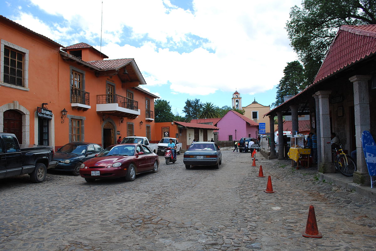
Sign In

My Timeline

GuRoute

Discover Your World

Share your Experiences

Record your Life


Top Attractions in Hidalgo

Tula

Tula is a Mesoamerican archeological site, which was an important regional center which reached its height as the capital of the Toltec Empire between the fall of Teotihuacan and the rise of Tenochtitlan. It has not been well studied in comparison to these other two sites, and disputes remain as to its political system, area of influence and its relations with contemporary Mesoamerican cities, especially with Chichen Itza. The site is located in the city of Tula de Allende in the Tula Valley, in what is now the southwest of the Mexican state of Hidalgo, northwest of Mexico City. The archeological site consists of a museum, remains of an earlier settlement called Tula Chico as well as the main ceremonial site called Tula Grande. The main attraction is the Pyramid of Quetzalcoatl which is topped by four, four metre high basalt columns carved in the shape of Toltec warriors. Tula fell around 1150, but it had significant influence in the following Aztec Empire, with its history written about heavily in myth. The feathered serpent god Quetzalcoatl is linked to this city, whose worship was widespread from central Mexico to Central America at the time the Spanish arrived. The Tula site is important to the history of Mesoamerica, especially the central highlands of Mexico, but it is generally overshadowed by its predecessor Teotihuacan and one of its successors, Tenochtitlan. The name Tula is derived from the Nahuatl phrase Tollan Xicocotitlan, which means 'near the cattails'. However, the Aztecs applied the term Tollan to mean 'urban center', and it was also used to indicate other sites such as Teotihuacan, Cholula and Tenochtitlan. The inhabitants of Tula were called Toltecs, but that term was later broadened to mean an urban person, artisan or skilled worker. This was due to the high respect in which the indigenous peoples in the Valley of Mexico held the ancient civilization before the Spanish conquest of the Aztec Empire. What remains of the ancient city is located in the southwest of what is now the state of Hidalgo, 75 km north of Mexico City. Geographically, it is in the Tula River Valley, at the south end of the Mesquite Valley in a region that indigenous records called Teotlapan . This area has an elevation of between 2000 and 2200 meters above sea level, with a semi-arid climate. It has only three continuously flowing rivers and streams, the largest of which is the Tula River. There are also a number of arroyos that flow during the rainy season. The modern archeological site consists of the ceremonial center of Tula Grande, an area called Tula Chico, the Jorge R. Acosta site museum and the Guadalupe Mastache Orientation center. The museum is at the entrance to the site and is named after one of the archeologists who worked on the site for years. The interior is organized into various sections and contains sculpted stone works as well as human remains. The Orientation center also contains a number of archeological pieces as well as posters and more explaining the site’s importance and relation to the rest of Mesoamerica. The city is aligned at 17 degrees east of true north, similar to structures at Teotihuacan although the first village was aligned with true north between 700-900CE. The ceremonial center of the city is located on a limestone outcropping, with steep banks on three sides, making it defensible. War and sacrifice are prominent themes at the site with images representing warriors such as jaguars and coyotes as well as eagles eating human hearts. There are also images of serpents eating skeletal figures and skulls in various areas. The main structures of the ceremonial center include two pyramids, including with the atlas figures, two main Mesoamerican ballcourts and several large buildings, one with a series of columns which faced a large plaza. The main ceremonial area has a number of architectural innovations that indicate societal changes. The large central plaza has space for 100,000 people. On three sides, there are long meeting halls with ceilings supported by columns all facing the plaza with over 1000 meters of benches, which have stone reliefs depicting warriors and others in procession. The architecture indicates a change from rituals performed by only a few people in closed spaces to large ceremonies to be viewed by many. These ceremonies were dominated by warriors. The major attraction of the site is Pyramid B also called the Pyramid of Quetzalcoatl or of the Morning Star. It is a five-tiered structure similar to the Temple of the Warriors at Chichen Itza. At the top of Pyramid B are four massive columns each carved in the likeness of Toltec warriors which once supported the roof of the temple on top of the pyramid. Each warrior figure is of basalt, four meters high, with an atlatl or spear thrower, incense, a butterfly shaped chest plate and a back plate in the shape of a solar disk. A large vestibule fronts the pyramid and connects it to nearby buildings. Today this vestibule and building are a space filled with broken columns. Building C is better known as the Burnt Palace named after evidence that it was burned. This pyramid is also surrounded by the Coatepantli or serpent wall, which was later the inspiration for a similar structure in Tenochtitlan. The earliest well-defined settlements in the Tula area appear around 400 BCE. Tula was probably settled by people of various ethnic backgrounds which may have included the Nonoalcas and the Chichimecas from the south and north respectively. The area probably was under the political control of Teotihuacan in the Epiclassic period, according to Teotihuacan designs found on Tula pottery. The area’s lime deposits were probably an important source for the plaster used in construction. At this time Tula was a small urban settlement with modest public architecture concentrated at Tula Chico . The constructions at Tula Chico are smaller than those in other Epiclassic sites, and was probably a minor player in the political and economic activity of the time. Tula Chico’s occupation is from 650 to 900. From 650 to 750, Tula Chico developed, and at its height spanned five to six km2, parts of which may be buried under Tula Grande. The population was somewhere between 19,000 to 27,000 at its height. Tula Chico was abandoned between 850 and 900CE, and Tula Grande began to develop. After the decline of Teotihuacan, there was a power vacuum with city states dominating small regions. Tula ceramics change during this period, as styles and techniques come under new influences. At the same time, settlement patterns of the area significantly changed with occupation mostly on hilltops and high hillsides. Architecture and pottery show influence from the west and north, with some from the east, suggesting a multiethnic population. The city rose to prominence after the fall of Teotihuacan and reached its height between 900 and 1150. Although Tula Grande grew to be larger than anything contemporary with it, it never grew to the size of Teotihuacan. The city at its height probably covered 14km2 with a population of about 60,000 with another 20,000 to 25,000 in the surrounding 1000km2, dominated by the ceremonial center of Tula Grande. Urban and rural house units indicated the importance of extended family groups but the scale of these seemed to have become smaller over time. Tula had defensive fortification at Las Ranas and Toluquilla against the Chichimecas. Its political sphere is thought to include most of the present state of Hidalgo, into the Valley of Mexico and possibly into the Toluca Valley and the Bajío. Much of this is done by comparison of ceramics but this can indicate political or economic influence. At that time, Tula was a fertile region near obsidian mines and on an important trade route. Its economic base was agriculture and the mining and crafting of obsidian. It appears the craft was practiced by about half of the occupants, along with the working of travertine and ceramics, taking over this function from Teotihuacan. Tula probably did not rule an empire but may have ruled a regional state. Long range contacts are indicated by the appearance of ceramics from eastern Mesoamerica, grey-green plumbate from southern Guatemala and polychrome ceramics from Costa Rica. Tula probably traded obsidian in return. The socioeconomics of Tula society is thought to have consisted of a ruling elite class, a craftsmen class, a merchant class and a large number of farm workers. Most of the farm workers were outside Tula proper with most of the other classes in the city. Excavations in the area have found evidence of the cultivation of chili peppers, amaranth, squash and maguey along with corn and beans. A number of wild plants were harvested including mesquite beans and cactus fruit. There is evidence of domesticated turkey and dog. Irrigated corn was the most important crop with anywhere from 3000 to 10000 hectares cultivated. It may not have been enough to feed the large population. There is an unoccupied area varying from one to three km wide which was probably agricultural. It has been proposed that the area received more rainfall during the Classic period than now which may have allowed for more large scale agricultural production without irrigation. It is probable that they had a form of hieroglyphic writing system, but no evidence exists except for an occasional glyph on a structure. Tula did not last as long as other Mesoamerican dominions. Around 1000, there were problems created by the leeching of soil and the drying of the climate. This moved Chichimecas south from their drying homelands creating ethnic strife which eventually resulted in the city’s collapse. Many of the living quarters appear to have been abandoned by 1150. It is not known when the ceremonial center fell but it was burned and the pyramids destroyed. There is evidence of the ceremonial center being burned in the 12th century. Ethnohistoric sources mention other rulers and a king list was developed from them. The chronology dates the destruction of Tula around 1179 while under the rule of Ce Acatl Topilitzin. However this story has been disputed. After the end of Tula, the site was looted, but it continued to be occupied through the rest of the Mesoamerican period and on into the colonial period. According to Bernardino de Sahagún, craftspeople were still found in Tula at the time of the conquest including scribes, stonecutters, masons, feather workers, potters and more. The site was determined to be that of Tollan and the Toltecs after ethnographic studies and archeological work from the 1950s to the 1970s. However, Tula is not well understood, especially in its relation to its predecessor of Teotihuacan and little has been published. No detailed archeological map of the city exists. Most studies have Tula remaining after the Epiclassic cities such as Teotihuacan collapsed, becoming the major power in the early post classic, but some archeologists dispute this, putting its height earlier with the other cities. Several misconceptions about the site include that it has no system of avenues, was relatively poor, had no walled residential complexes and had only small mound clusters. It did have a grid system but it had several major reorientations. Large residential complexes have been unearthed just outside the ceremonial center. The elite also had access to much of the finest handcrafted items then available in Mesoamerica. The size and nature of the city’s political sphere is in dispute. There are no written records and the archeological evidence is scant. There is evidence of Tula influence in other parts of Mesoamerica, mostly seen in pottery in Tula and in other areas. One of the most debated questions is what, if any, relationship there might be between Tula and Chichén Itzá far to the south in the Yucatán Peninsula. The idea comes from the fact that there are similarities in various art and architectural styles. It is certain that neither could have conquered the other, but there is evidence that they may have been connected through trade networks. By the time of the Spanish conquest, Quetzalcoatl, the feathered serpent deity was widely worshipped from what is now central Mexico down into Central America. The god is linked to a legendary ruler of Tula, Ce Acatl Quetzacoatl, who was often simply referred to as Quetzalcoatl. Mythological accounts surrounding the fall of Tula have this ruler succumbing to temptation by a dark deity named Tezcatlipoca, causing the destruction of the city. The fallen ruler then wanders to the Gulf Coast, immolates himself becoming the morning star . The history of the city remained important up through the Aztec Empire and is reported in the codices written after the Spanish conquest. However, most of these stories are heavy in myth. These tend to start with the Toltecs and the city of Tula, followed by the migration of the Mexica to the Valley of Mexico. The stories either portray Tula as a kind of paradise in which the inhabitants master the sciences and arts or a city filled with strife headed for a downfall. In these the last ruler, Quetzalcoatl, is a legendary being with archetypical qualities. Much of Toltec history was lost when Izcoatl burned the history books after founding the Aztec Empire. The planning of Tula was adopted by some Aztec city-state rulers for their urban centers.

Tolantongo

Tolantongo is a box canyon and resort located 17 kilometres from Ixmiquilpan on Route 27 in the Mezquital Valley, State of Hidalgo in Mexico, It is about 1.5 hours northeast of Pachuca and 198 km or three-to-four hours northeast of Mexico City. The closest village to the resort is called El Cardonal and it is part of Cardonal Municipality. The resort is made up of three hotel complexes and heated pools near the bottom of a steep box canyon that has walls as many as 500 meters high. Its main attraction is two grottos at the canyon’s closed end, out of which flows a small volcanically-heated river which follows the canyon floor. The large grotto chamber is about half the size of a tennis court with a ceiling of up to ten metres. Above the grotto is a “tunnel”, a small cavern 15 metres deep in which warm water showers those who venture inside. Around these two openings, warm waterfalls flow down the steep canyon walls Here visitors can practice hiking, rappelling and spelunking. The resort is located in a semi-desert zone, surrounded by rock formations carved by water flow and geological pressures. Exposed rock shows sedimentary layers that have folded. This and water erosion have created capricious forms that are all around this part of Hidalgo state. The high peaks in this area are often shrouded in mist. Cacti and semi-arid vegetation predominate in the hills above the canyon, with pine trees at the higher elevations. The rugged peaks have a great deal of biological diversity. Among the plant species to be found are yucca , mesquite , tall cacti called “viejitos” , named so because their upper spines whiten and flatten, creating a grey-hair-like look, gumbo-limbos , poinsettias as well as the abundant magueys that have been used for centuries to make pulque, a fermented beverage. Animals that can be seen include raccoons , greater roadrunners (Geococcyx californianus), hooded skunks (Mephitis macroura), white-nosed coatis (Nasua narica) and white-winged doves (Zenaida asiatica). Also, the area has been inhabited by various indigenous peoples such as the Otomi, the Mexica, the Toltecs and the Tepehua. To arrive at the resort, one must leave the highway and travel down an unpaved road that winds its way down the side of one of the canyon walls. At the bottom of the canyon, the vegetation changes from semi-desert to semi-tropical due to the abundance of water and the humid warmth the river and falls give to the place. In some areas, the vegetation is quite exuberant. The beauty of the area enticed a Mexican soap opera or “telenovela” to shoot a number of romantic scenes here. The river in the canyon is also called Tolantongo. It is pleasantly warm, colored by mineral salts it picks up as it passes through the mountain. The water comes from a complex series of channels inside the mountain that heats the water to about 20 degrees Celsius. Much of this water dwells in niches in the rocky side of the canyon, which has a cooling effect. Another factor is that the water mixes with unheated water as it leaves the grottoes. The result is mostly tepid water outside the grottoes and in the river itself, good for swimming even on a cold day. There are two main grottos: the larger one from which the river flows and the “tunnel” above it on the same wall of the canyon. The larger grotto is classified as a karst cave, and was closed for a short time in 2004 due to a roof collapse. Inside this cave, the temperature rises noticeably and it is filled with stalactites and stalagmites. Just outside the main grotto are rimstone pools in which visitors can wallow in the shallow river as the water rushes past. The “tunnel” is called this due to its shape; narrow and about 15 meters long. Visitors inside the tunnel are showered by warm water that sprays out from the walls and ceiling. The temperature inside is similar to that of a steam bath. Inside one part there is a depression filled by a stream of water that one can swim in. This pool is filled with capriciously-shaped rocks. In both grottos, one can listen to the echoes of the waterfalls inside the mountain. It is possible to rappel from the various high domes in these two grottos, but it is still considered dangerous because of the wet walls and large amounts of water vapor in the air. On various sections of the canyon walls are man-made semi-circular “chapoteaderos” or splashing pools, created by damming small warm springs. Most of these are shaded by trees, allowing tourists to bath in warm waters while overlooking the canyon at the same time. Similar to the chapoteaderos, but created naturally, La Gloria is a set of three pools that run down one of the walls of the canyon. Curiously, the water is warm in the uppermost pool, cool in the middle pool and warm again in the bottom pool. Water falls all around these three pools in trickles and large streams. There are also camping and sanitary facilities by these pools. The resort does not have the usual managerial structure. The grottos and the resort belong to the “Socieded Cooperative Ejidal “Grutas Tolantongo””(Cooperative Ejido Society of the Tolantongo Grottos). This association was formed 30 years ago by the 112 families that own the ejido (a type of communal property) (Bowman), called San Cristobal. This ejido has about 5,200 hectares, with only 40 open to the public. All workers belong to these ejido families and dress similarly, no matter what their job. While certain jobs do pay more, these rotate among members. Each family gets a vote in the affairs of the ejido. The project was launched in the 1970s with neither outside expertise nor government help and still functions without outside resources. A percentage of the resort’s profits are reinvested back into the enterprise. While today the park and resort are well-run and tranquil, the enterprise had problems with drugs, violence and vandalism when it first began. Working with local authorities, they created barriers to control access and gained permission to carry firearms as deputies to patrol ejido land. Despite the problems and the lack of governmental help, the ejido association has managed to preserve much of the resort and the ejido land around it in its natural state. Most of the canyon area is owned by the association but two ejidos share the area, each owning one side of the canyon. The side with La Gloria is owned by another ejido, La Mesa, and charges separately. The resort is open every day with pools, a restaurant, grocery store and campgrounds in addition to the three hotels and campgrounds. Buses run from Mexico City to Ixmiquilpan. From there small buses run to Tolantongo. Public transport to the grottoes is infrequent, as most visitors arrive by car.

Huapalcalco

Huapalcalco is an archeological site located some 5 kilometers north of Tulancingo in the state of Hidalgo, Mexico. The site was built on the west slope of the "Tecolote" hill; the slope is separated east-west by a ravine that forms two sectors at the foot of the hill and two more on the top, all of which contain archaeological vestiges. The site depicts Teotihuacán influence, and some believe that Topilitzin Quetzalcóatl resided here, before governing Tula. Also it is considered the oldest human occupation site in the Hidalgo State. It is believed that it must have been a very important civil, religious and housing center. It is known that it was the second Toltec Empire, before Tula. The city was of olmeca-xicalanca origin, or the first settler tribes of the great central plateau of the mountain range. The meaning of such wooden building is not known, it was probably built when the ancient native people settled; perhaps it was a building destined as a Telpochcalli, for military training, justice administration, or learning dances or music. Men passed through the Bering Straits 40 thousand years, 30 thousand years ago, men reached the Mexican plains and about 13 thousand years ago, men reached Huapalcalco in the Hidalgo, State, where vestiges have been located that date back to that period. However, Huapalcalco is a mesoamerican classical period , formed part of the State Teotihuacan, however, both its architecture and pottery is not equal to Teotihuacan, i.e. there is Teotihuacan influence, but are not Teotihuacan. It is not known what culture built these monuments; it can only be said that it is closely related to the Teotihuacan culture and had influence of the cultures of the Gulf Coast.

Pachuca

Pachuca, formally known as Pachuca de Soto, is the capital and largest city of the Mexican state of Hidalgo. It is located in the south-central part of the state. Pachuca de Soto is also the name of the municipality of which the city serves as municipal seat. Pachuca is located about 90 kilometres from Mexico City via Mexican Federal Highway 85. There is no consensus about the origin of the name Pachuca. It has been traced to the word pachoa Pachoacan and patlachuican . The official name of Pachuca is Pachuca de Soto in honor of congressman Manuel Fernando Soto, who is given credit for the creation of Hidalgo state. Its nickname of “La bella airosa” comes from the strong winds that blow into the valley through the canyons to the north of the city. In the indigenous Otomi language, Pachuca is known as Nju̱nthe. The area had been long inhabited but except for some green obsidian, but the mining that Pachuca is famous for began in the mid-16th century, during Spanish colonial rule. Pachuca remained a major mining center until the mid-20th century, with the city’s fortunes going up and down with the health of the mining sector. In the mid-20th century a major downturn in mining pushed Pachuca to change the basis of its economy to industry, resulting in the revamping of the Universidad Autónoma de Hidalgo. Today mining forms only a fraction of the municipality’s economy. One cultural aspect that makes Pachuca stand out is the influence that Cornish miners who immigrated here in the 19th century have had. Many of their descendents remain in Pachuca and nearby Real del Monte, as well as two heritages that define the city, soccer and a dish called “pastes.”

This attraction is located in

This is a private property. Please enjoy respectfully and do not disturb the occupants.

Edit Categories
Add Tours

This attraction is not part of any tours

Add Collections

This attraction is not part of any collections


Some of the attractions we imported from Wikipedia are not perfect. Send us an email detailing what's wrong and we'll look into fixing it.

GuRoute is all about Gurus sharing their local knowledge. If you feel up to fixing this problem yourself, why not adopt it. You will become the owner and can fix whatever problems you see.

We've copied a link to this attraction into your clipboard so that ou can paste it into an email or text message...

More Info...
You can add your friends to the visit yourself, or, send them a link and let them add themselves...

The visit will appear on both your timelines and on your Shared Timeline.

Click below and we'll email you a link that you can send on to friends or post on your group's Facebook page.

If your friends aren't members of GuRoute yet, this is a great way to get them started.
Recent
Recently used Collections will appear here...
Recent
Recently used tours will appear here...

Where is this?

GuRoute likes to place attractions inside other attractions. So, maybe it's in a city, or maybe it's inside a particular park in that city. Maybe your attraction is a huge park that spans half the county, or multiple counties.

Determining where this attraction is gives it context - if it's in a park, you'll be able to see it alongside all the other attractions in that park. And that helps define the park.

GuRoute will automatically calculate a parent region for this attraction. You can change it if there is something more appropriate.

This attraction is currently located in .

Change

This attraction does not yet have any reviews

Please login to write a review...

Reviewed by
Record new Visit

Add this location to your timneline?

  • If there's an existing attraction open it and add it to your timeline...
  • If not, enter a title and we'll create a new attraction for your memories...
Create new Attraction

Create a new attraction at this location?

  • We rely on Gurus like you to share your local knowledge...
(Give a name for this location)


+
Add this to your timeline instead...

Imagine having a record of all the cool things you've done in your life!


Using our timeline you can keep track of everywhere you visit in your lifetime...

But, you'll need to sign in first...

Add contacts so that you can share your travels and record places that you visit together...

Family
Favorites
Family
Favorites

Profile TimeLine Our Visits Edit Accept Decline Invite

If you have any more friends that visited this place with you, feel free to add them to the visit. We'll write it to their timeline and once they confirm it, they too will have this memory for a lifetime.

If they're not already registered, you just need their name and email address and you can add them and we'll send them an invite on your behlaf.

Add a tour comment

Add some extra information for when this attraction is viewed as part of your tour...

Next Stop Instructions

Add some instructions for what to see/do on the way to the next stop...

Next Stop Instructions

Add some instructions for what to see/do on the way to the next stop...

If you're visiting an existing attraction, open it and add it to your timeline. If there is no attraction for the place you are visiting...

  • Click 'Add My Location' below
  • Or right-click on the map to mark a different location
  • Or long-press if you have a touch screen
You can even add locations while you're offline....
  • Load up the map when you're online and we'll keep track of your locaiton
  • You can add locations to your timeline
  • When you are online again we'll sync them with the cloud

We can't connect to the internet right now. The following attractions are saved locally and can be uploaded when you're online...

GuRoute would like to access your current location so that we can pin you on the map and show you nearby attractions

Add friends so that you can share your experiences with each other...

Add tour to What's Next?

Go...

Either for yourself or someone else...

  1. Do your trip research in GuRoute
    Add all the places that you think might be worthy of a visit into a trip-plan
  2. Add your trip-plan to your "What's Next" timeline
    (or a friend's "What's Next" timeline)
  3. When you're on vacation you'll have all your research at your fingertips
  4. Share your timline with your friends
    They can enjoy your vacation with you, seeing not only where you've been, but where you're going next...
  5. Add/remove attractions if things change

It also makes a great souvenir of your trip

Collections

Go...

Create a home page for a collection of attractions

  • Add an image and description to display on the homepage
  • Start adding content
    Add existing attractions to your collection or create new attractions of your own
  • Collections can be:
    • Public (Anyone can add attractions to your collection)
    • Shared (Only yourself and Gurus you nominate can add content)
    • Private (The collection will only be visible to yourself)

Uses

  • Local business or hotel
    Showcase local attractions that you endorse
  • Clubs
    Showcase attractions that members have created (eg. local historical society)
  • Special Interest
    If GuRoute does not have a category for your special interest you add your attractions to your own collection instead

Examples

Walking/Driving Tours

Go...

A guided tour where GuRoute will direct you from stop to stop and narrate a description of each attraction you arrive at

  • GuRoute uses your phone's GPS to guide you from stop to stop
  • GuRoute automatically detects when you arrive at the next tour-stop and narrates the description of the attraction (Chrome Only)
  • It then sends you on to the next stop

Tours are great to attract people to your town. Even places with no significant points of interest can be lots of fun when part of a tour


Cater tours to your Audience

  • Kid-friendly Tours
    • Focus on what will keep kids interested
    • Instead of parents having to drag their kids around they'll be struggling to keep up
    • Let the kids navigate and they'll get more fun out of finding that historical plaque than they ever would from reading it
  • Accessible tours
  • Short and long tours of the same location

What you need to do...

  1. Click 'Go...'
    Enter a title, description and location for the tour
  2. Add existing attractions OR create new ones and add them to the tour
  3. For existing attractions you can add more information specific to the theme of the tour
  4. You can also add instructions on what to do or see en-route to the next tour-stop
  5. Try out your tour and see how it works...

Mystery Tour

Go...

Create a Mystery Tour

Create a series of clues to show people around a city, neighborhood or whatever place you like...

  • GuRoute will show people clues to get them from attraction to attraction
  • When they reach each stop GuRoute will tell them about the place and give them the next clue
  • Take as long or as you like and explore each location at your leisure

Scavenger Hunt

Go...

Create a Scavenger Hunt

Create a series of questions that people have to answer. The answers can all be discovered by walking aroung the area, looking for clues.

  • How many beers are on tap at Michael Collin's Irish Bar?
  • What's the name of the oldest building on main streeet?
  • Show a picture of some public art and ask them what it is called
  • Clues can have numeric or multiple choice answers