Sign In

My Timeline

GuRoute

Discover Your World

Share your Experiences

Record your Life


Top Attractions in Golan

Banias

Banias is the Arabic and modern Hebrew name of an ancient site that developed around a spring once associated with the Greek god Pan, in the vicinity of the town of Caesarea Philippi. The site contains a spring which is located at the foot of Mount Hermon, north of the Golan Heights, and constitutes one of the main sources of the Jordan River. Archaeologists uncovered a shrine dedicated to Pan and related deities, and the remains of an ancient city founded sometime after the conquest by Alexander the Great and inhabited until 1967; the ancient city was mentioned in the Gospels of Matthew and Mark by the name of Caesarea Philippi. The first mention of the ancient city during the Hellenistic period was in the context of the Battle of Panium, fought around 200-198 BCE, when the name of the place was given as "Panion". Later the region was called "Paneas" . Both names were derived from that of Pan, the god of the wild and companion of the nymphs. The spring at Banias initially originated in a large cave carved out of a sheer cliff face which was gradually lined with a series of shrines. The temenos included in its final phase a temple placed at the mouth of the cave, courtyards for rituals, and niches for statues. It was constructed on an elevated, 80m long natural terrace along the cliff which towered over the north of the city. A four-line inscription at the base of one of the niches relates to Pan and Echo, the mountain nymph, and was dated to 87 BCE. The once very large spring gushed from the limestone cave, but an earthquake moved it to the foot of the natural terrace where it now seeps quietly from the bedrock, with a greatly reduced flow. From here the stream, called Nahal Hermon in Hebrew, flows towards what once were the malaria-infested Hula marshes.

Valley of Tears

The Valley of Tears is the name given to an area in the Golan Heights after it became the site of a major battle in the 1973 Yom Kippur War, known as the Valley of Tears Battle. Although massively outnumbered, the Israeli forces managed to hold their positions and on the fourth day of the battle the Syrians withdrew. Background 
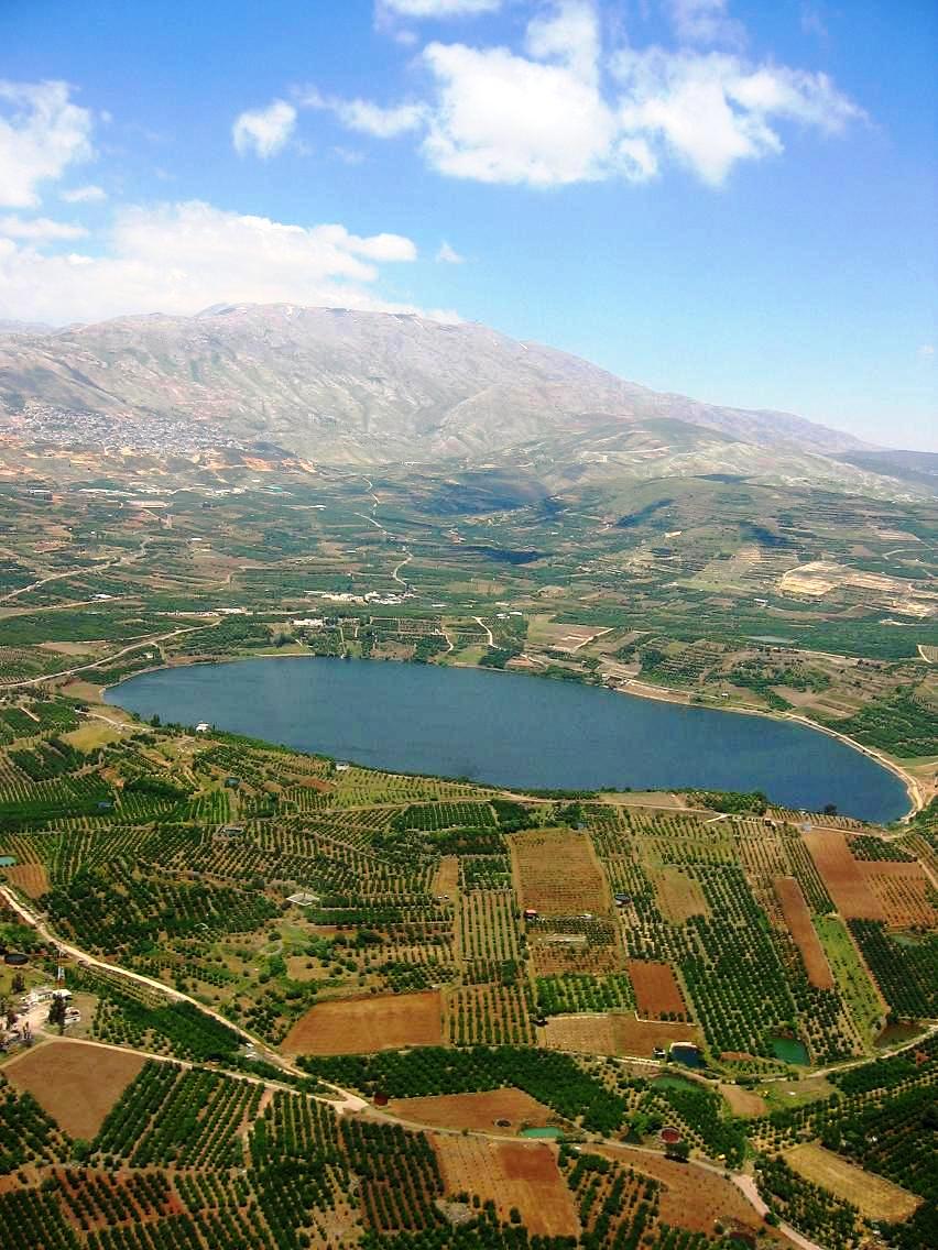
The Golan Heights are made up of a 1240-square-kilometre volcanic rock plateau perched above the Hula Valley and the Sea of Galilee to the west, the Yarmouk Valley to the south, and bordering on Mount Hermon to the north. Israel in the 1967 war had advanced against the routed Syrians until a defensible line was reached, a string of extinct volcano cones that commands strategic views of all northern Israel on one side and of Damascus on the other. The 1967 cease-fire line was known as the Purple Line, and marked the end of the no man's land separating Syria from the now Israeli-occupied part of the Golan, comprising the western two-thirds of the region. Lacking a true defensive barrier, the Israelis had dug a 32-kilometre-long anti-tank ditch along the border from Mount Hermon to Rafid, an obstacle Syrian armor would be forced to cross under fire from Israeli tanks positioned behind ramparts. Israeli defending forces The Golan Heights were defended by two IDF armored brigades: the Israeli 7th Armored Brigade, which had only been dispatched to the northern sector on October 4, and the 188th Barak Armored Brigade, a regular fixture intimately familiar with the area's terrain, in the south. The 7th Armored Brigade and the 188th Barak Armored Brigade were armed mainly with Israel's modified Centurion "Sho't Kal" tanks and a few modified M48 Patton "Magach" tanks. The modified Centurion and M-48 Patton tanks fielded by both brigades were fitted with the 105mm Royal Ordnance L7 gun and modern diesel engines. Syrian battle plan and forces The Syrian plan called for three mechanized infantry divisions , in BTR-50 armored personnel carriers supported by 900 tanks, to breach the Israeli lines, opening the way for the 1st and 3rd armored divisions to move in with their 500 tanks to capture the entire Golan Heights before Israel had a chance to mobilize. When the battle began, approximately 400 of the Syrian tanks were T-62s, the most modern Soviet-bloc tank at the time, equipped with a 115mm smoothbore gun and infrared night-fighting capability. The balance were T-54s and T-55s armed with 100mm guns. For months before the attack, Syrian forces worked on creating a false sense of security among the Israelis by repeatedly removing their tanks' camouflage netting and arranging their tanks in battle formation below the Golan Heights. The Syrian tanks would remain in formation for a few days and then return to base. Syrian attack On 6 October 1973 the Syrians launched simultaneous attacks in the north and the south and attacked the two Israeli brigades and eleven supporting artillery batteries with five divisions and 188 batteries. They began their attack with an airstrike by about 100 aircraft and a 50-minute artillery barrage. The Syrian mechanized 7th Infantry Division attacked the Israeli 7th Armored Brigade in the northern area between Mount Hermonit and a southern ridge known as "Booster" in Israel, or Tel el Mekhafi in Arabic, a narrow front soon to be known as the "Valley of Tears". The Syrians started the offensive with mine-clearing tanks and bridge-layers leading the way to overcome the Israeli obstacles. They gained much ground at the start, but failed to move tanks across the anti-tank ditch. Only at night did they penetrate the Israeli defenses with the help of night vision equipment—equipment that the Israelis lacked. Initially, Israel was able to deploy only 176 tanks: Sho'ts and Magachs used by the Barak Brigade in the south and the 7th Armored Brigade in the north. The next day, the Syrians mounted a second attack, and at one point in the engagement less than forty Israeli tanks, of which the Barak Brigade only had 15 serviceable ones, were facing approximately 500 Syrian tanks. The Israeli 74th Tank Battalion, under the command of Lt.Col. Yair Nafshi, was moved to its battalion position 1.5 km forward from its previous defensive position, a maneuver that saved tanks from the Syrian artillery barrage. During the battle, Lieutenant Zvika Greengold, who had arrived unattached to any unit, fought off attacks with his single tank until help arrived. "For the next 20 hours, Zvika Force, as he came to be known on the radio net, fought running battles with Syrian tanks—sometimes alone, sometimes as part of a larger unit, changing tanks half a dozen times as they were knocked out. He was wounded and burned but stayed in action and repeatedly showed up at critical moments from an unexpected direction to change the course of a skirmish." The Syrian force split into a two-pronged advance. Colonel Tewfik Jehani's 1st Armored Division moved northward toward the Golan command headquarters of Maj. Gen. Rafael Eitan, situated at Nafekh on the road leading down to the Bnot Yaakov Bridge, over the Jordan River and into the Israeli hinterland. The second prong of the Syrian attack, spearheaded by the 46th Armored Brigade of the 5th Infantry Division, moved south from Rafid on the southern access road toward El Al, with units breaking off toward the north in the direction of the Arik Bridge at the northern tip of the Sea of Galilee. Every Israeli tank deployed on the Golan Heights was engaged during the initial attacks. Reservists were alerted and began to arrive at the scene and were sent to the front as soon as they arrived at army depots, without waiting for the crews they trained with to arrive, machine guns to be installed on the tanks, or taking the time to calibrate the tank guns (a time-consuming process known as bore-sighting). The Syrians had expected it to take at least 24 hours for Israeli reserves to reach the front lines; in fact, reserve units began reaching the battle lines only 15 hours after the war began. Israeli reserve forces approaching the Golan Heights were subjected to Syrian artillery fire directed from Mount Hermon. On the second and third day, Syrian forces suffered heavy losses as Israeli tanks and infantry fought desperately to buy time for all the reserve forces to reach the front lines, and conducted stopgap blocking actions whenever the Syrians were on the verge of breaking through. However, the Syrians pressed the attack in spite of their losses, and the vastly outnumbered defenders lost numerous tanks. By the afternoon of October 9, the IDF's 7th Brigade was down to six tanks protecting what was for all intents and purposes a clear path into Israel's north. On the fourth day, the 7th Brigade received a small reinforcement force when it had less than a dozen operating tanks and was almost out of ammunition. The Syrians, exhausted from three days of continuous fighting and unaware of how close to victory they actually were, turned in retreat. Hundreds of destroyed tanks and APCs littering the valley below the Israeli ramparts were testimony to the horrible destruction that had taken place there. Within 5 days, the Syrians had lost almost 1,000 tanks. The Syrians retreated for reasons that are still debated.

This attraction is located in

This is a private property. Please enjoy respectfully and do not disturb the occupants.

Edit Categories
Add Tours

This attraction is not part of any tours

Add Collections

This attraction is not part of any collections


Some of the attractions we imported from Wikipedia are not perfect. Send us an email detailing what's wrong and we'll look into fixing it.

GuRoute is all about Gurus sharing their local knowledge. If you feel up to fixing this problem yourself, why not adopt it. You will become the owner and can fix whatever problems you see.

We've copied a link to this attraction into your clipboard so that ou can paste it into an email or text message...

More Info...
You can add your friends to the visit yourself, or, send them a link and let them add themselves...

The visit will appear on both your timelines and on your Shared Timeline.

Click below and we'll email you a link that you can send on to friends or post on your group's Facebook page.

If your friends aren't members of GuRoute yet, this is a great way to get them started.
Recent
Recently used Collections will appear here...
Recent
Recently used tours will appear here...

Where is this?

GuRoute likes to place attractions inside other attractions. So, maybe it's in a city, or maybe it's inside a particular park in that city. Maybe your attraction is a huge park that spans half the county, or multiple counties.

Determining where this attraction is gives it context - if it's in a park, you'll be able to see it alongside all the other attractions in that park. And that helps define the park.

GuRoute will automatically calculate a parent region for this attraction. You can change it if there is something more appropriate.

This attraction is currently located in .

Change

This attraction does not yet have any reviews

Please login to write a review...

Reviewed by
Record new Visit

Add this location to your timneline?

  • If there's an existing attraction open it and add it to your timeline...
  • If not, enter a title and we'll create a new attraction for your memories...
Create new Attraction

Create a new attraction at this location?

  • We rely on Gurus like you to share your local knowledge...
(Give a name for this location)


+
Add this to your timeline instead...

Imagine having a record of all the cool things you've done in your life!


Using our timeline you can keep track of everywhere you visit in your lifetime...

But, you'll need to sign in first...

Add contacts so that you can share your travels and record places that you visit together...

Family
Favorites
Family
Favorites

Profile TimeLine Our Visits Edit Accept Decline Invite

If you have any more friends that visited this place with you, feel free to add them to the visit. We'll write it to their timeline and once they confirm it, they too will have this memory for a lifetime.

If they're not already registered, you just need their name and email address and you can add them and we'll send them an invite on your behlaf.

Add a tour comment

Add some extra information for when this attraction is viewed as part of your tour...

Next Stop Instructions

Add some instructions for what to see/do on the way to the next stop...

Next Stop Instructions

Add some instructions for what to see/do on the way to the next stop...

If you're visiting an existing attraction, open it and add it to your timeline. If there is no attraction for the place you are visiting...

  • Click 'Add My Location' below
  • Or right-click on the map to mark a different location
  • Or long-press if you have a touch screen
You can even add locations while you're offline....
  • Load up the map when you're online and we'll keep track of your locaiton
  • You can add locations to your timeline
  • When you are online again we'll sync them with the cloud

We can't connect to the internet right now. The following attractions are saved locally and can be uploaded when you're online...

GuRoute would like to access your current location so that we can pin you on the map and show you nearby attractions

Add friends so that you can share your experiences with each other...

Add tour to What's Next?

Go...

Either for yourself or someone else...

  1. Do your trip research in GuRoute
    Add all the places that you think might be worthy of a visit into a trip-plan
  2. Add your trip-plan to your "What's Next" timeline
    (or a friend's "What's Next" timeline)
  3. When you're on vacation you'll have all your research at your fingertips
  4. Share your timline with your friends
    They can enjoy your vacation with you, seeing not only where you've been, but where you're going next...
  5. Add/remove attractions if things change

It also makes a great souvenir of your trip

Collections

Go...

Create a home page for a collection of attractions

  • Add an image and description to display on the homepage
  • Start adding content
    Add existing attractions to your collection or create new attractions of your own
  • Collections can be:
    • Public (Anyone can add attractions to your collection)
    • Shared (Only yourself and Gurus you nominate can add content)
    • Private (The collection will only be visible to yourself)

Uses

  • Local business or hotel
    Showcase local attractions that you endorse
  • Clubs
    Showcase attractions that members have created (eg. local historical society)
  • Special Interest
    If GuRoute does not have a category for your special interest you add your attractions to your own collection instead

Examples

Walking/Driving Tours

Go...

A guided tour where GuRoute will direct you from stop to stop and narrate a description of each attraction you arrive at

  • GuRoute uses your phone's GPS to guide you from stop to stop
  • GuRoute automatically detects when you arrive at the next tour-stop and narrates the description of the attraction (Chrome Only)
  • It then sends you on to the next stop

Tours are great to attract people to your town. Even places with no significant points of interest can be lots of fun when part of a tour


Cater tours to your Audience

  • Kid-friendly Tours
    • Focus on what will keep kids interested
    • Instead of parents having to drag their kids around they'll be struggling to keep up
    • Let the kids navigate and they'll get more fun out of finding that historical plaque than they ever would from reading it
  • Accessible tours
  • Short and long tours of the same location

What you need to do...

  1. Click 'Go...'
    Enter a title, description and location for the tour
  2. Add existing attractions OR create new ones and add them to the tour
  3. For existing attractions you can add more information specific to the theme of the tour
  4. You can also add instructions on what to do or see en-route to the next tour-stop
  5. Try out your tour and see how it works...

Mystery Tour

Go...

Create a Mystery Tour

Create a series of clues to show people around a city, neighborhood or whatever place you like...

  • GuRoute will show people clues to get them from attraction to attraction
  • When they reach each stop GuRoute will tell them about the place and give them the next clue
  • Take as long or as you like and explore each location at your leisure

Scavenger Hunt

Go...

Create a Scavenger Hunt

Create a series of questions that people have to answer. The answers can all be discovered by walking aroung the area, looking for clues.

  • How many beers are on tap at Michael Collin's Irish Bar?
  • What's the name of the oldest building on main streeet?
  • Show a picture of some public art and ask them what it is called
  • Clues can have numeric or multiple choice answers