Sign In

My Timeline

GuRoute

Discover Your World

Share your Experiences

Record your Life


North Korea

Pyongyang

"Pyongyang" literally means "Flat Land" in Korean. One of Pyongyang's many historic names is Ryugyong , or "capital of willows", as willow trees have always been numerous throughout the city's history; this served as an inspiration for many poems. Even today, the city has numerous willow trees, with many buildings and places having "Ryugyŏng" in their names. The most notable of these is the Ryugyong Hotel, completed in 2011. The city's other historic names include Kisong, Hwangsong, Rakrang, Sŏgyong, Sodo, Hogyong, Changan, and Heijo (during Japanese rule in Korea). During the early 20th century, Pyongyang came to be known among missionaries as being the "Jerusalem of the East", due to its historical status as a stronghold of Christianity, namely Protestantism. After Kim Il-sung's death in 1994, some members of Kim Jong-il's faction proposed changing the name of Pyongyang to "Kim Il-sung City" (김일성시), but others suggested that North Korea should begin calling Seoul as "Kim Il-sung City" instead and grant Pyongyang the moniker "Kim Jong-il City", and in the end neither proposal was implemented. 
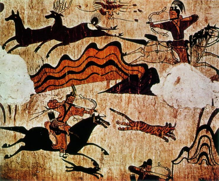
In 1955, archaeologists excavated evidence of prehistoric occupation in a large ancient village in the Pyongyang area, called Kŭmtan-ni, dating to the Chŭlmun and Mumun pottery periods. North Koreans associate Pyongyang with "Asadal" (아사달), or Wanggomsŏng (왕검성; 王儉城), the first second millennium BC capital of the Gojoseon kingdom according to Korean history books, notably Samguk Yusa. Many South Korean historians deny this claim because other Korean history books such as the Guanzi, Sanhaijing, Shiji, and Sanguozhi place Asadal around the Liao River located in western Manchuria. The connection between the two therefore may have been asserted by North Korea for the use of propaganda. Nevertheless, Pyongyang became a major city under Gojoseon. Pyongyang was founded in 1122 BC on the site of Tangun Dynasty's capital, according to legends. It is likely that the area of Pyongyang belonged to Wiman Joseon, the shortest-lasting part of Gojoseon if both Dangun and Gija Joseon were real, which fell in the Gojoseon–Han War in 108 BC. Emperor Wu of the Han dynasty ordered four commanderies be set up, with Lelang Commandery in the center and its capital established as 平壤 (Old Chinese: *breŋ*naŋʔ, modern Mandarin: píngrǎng, Korean: pyongyang). Several archaeological findings from the later, Eastern Han (25–220 AD) period in the Pyongyang area seems to suggest that Han forces later launched brief incursions around these parts. The area around the city was called Nanglang during the early Three Kingdoms period. As the capital of Nanglang kingdom (낙랑국), Pyongyang remained an important commercial and cultural outpost after Lelang Commandery was destroyed by an expanding Goguryeo in 313. Goguryeo moved its capital there in 427. According to Christopher Beckwith, Pyongyang is the Sino-Korean reading of the name they gave it in their language: Piarna, or "level land". In 668, Pyongyang became the capital of the Protectorate General to Pacify the East established by the Tang dynasty of China. However, by 676, it was taken by Silla, but left on the border between Silla and Balhae (Bohai). This lasted until the time of the Goryeo dynasty, when the city was revived as Sŏgyŏng (Hangul: 서경; hanja: 西京; "Western Capital") although it was never actually a capital of the kingdom. It was the provincial capital of the Pyeongan Province during the Joseon dynasty. During the Japanese invasions of Korea (1592–98), Pyongyang was captured by the Japanese until the Japanese were defeated in the Siege of Pyongyang. Later in the 17th century, it became temporarily occupied during Second Manchu invasion of Korea until peace arrangements were made between Korea and the Manchus. While the invasions made Koreans suspicious of foreigners, the influence of Christianity began to grow after the country opened itself up to foreigners in the 16th century. Pyongyang became the base of Christian expansion in Korea, and by 1880 it had more than 100 churches and more Protestant missionaries than any other Asian city. In 1890, the city had 40,000 inhabitants. It was the site of an important battle during the First Sino-Japanese War, which led to the destruction and depopulation of much of the city. However, it was the provincial capital of South Pyeongan Province from 1896. Under colonial rule, the city became an industrial center, called Heijō in Japanese. In July 1931 the city experienced anti-Chinese riots as a result of the Wanpaoshan Incident and the sensationalized media reports of the incident which appeared in Imperial Japanese and Korean newspapers. By 1938, Pyongyang had a population of 235,000. On 25 August 1945, the 25th army of the Soviet Army entered Pyongyang, and it became the temporary capital of the Provisional People's Committee for North Korea. A People's Committee was already established there, led by veteran Christian nationalist Cho Man-sik. Pyongyang became the de facto capital of the Democratic People's Republic of Korea at its establishment in 1948. At that time, the Pyongyang government aimed to recapture Korea's official capital at that time, Seoul. Pyongyang was again severely damaged in the Korean War, during which it was briefly occupied by South Korean forces from 19 October to 6 December 1950. In 1952, it was the target of the largest aerial raid of the entire war, involving 1,400 UN aircraft. After the war, the city was quickly rebuilt with Soviet aid, with many buildings built in the style of Socialist Classicism. The plans for the modern city of Pyongyang were first displayed for public viewing in a theatre building. On 27 July 1953 – the day the armistice between North Korea and South Korea was signed – The Pyongyang Review wrote: "While streets were in flames, an exhibition showing the general plan of restoration of Pyongyang was held at the Moranbong Underground Theater", the air raid shelter of the government under Moran hill. "On the way of victory... fireworks which streamed high into the night sky of the capital in a gun salute briefly illuminated the construction plan of the city which would rise soon with a new look". In 2001, the authorities began a long-term modernization program. The Ministry of Capital City Construction Development was included in the cabinet in that year. In 2006, Kim Jong-il’s brother-in-law Jang Song-thaek took charge of the ministry. Major government and other public offices are located in Pyongyang, which is constitutionally designated as the country's capital. The seat of the Workers' Party Central Committee is located in Haenbangsan-dong, Chung-guyok. Pyongyang People's Committee is located in Haebangsan-dong, Chung-guyok. The Cabinet of North Korea is located in Jongro-dong, Chung-guyok. Pyongyang is also the seat of all major North Korean security institutions. The largest of them, the Ministry of People's Security, has 130,000 employees working in 12 bureaus. These oversee activities as diverse as police services, security of party officials, classified documents, census, civil registrations, large-scale public construction, traffic control, fire safety, civil defense, public health and customs. Another major structure based in the city is the State Security Department, whose 30,000 personnel manage intelligence, political prison systems, military industrial security and entry and exit management. The politics and management of the city is dominated by the Workers' Party of Korea, as they are in the national level. The city is managed by the Pyongyang Party Committee of the Workers' Party of Korea. The supreme standing state organ is the Pyongyang People's Committee, responsible for everyday events in support of the city. This includes following local Party guidance as channeled through the Pyongyang Party Committee, the distribution of resources prioritized to Pyongyang, and providing support to KWP and internal security agency personnel and families.

Complex of Goguryeo Tombs

The Complex of Goguryeo Tombs lie in North Korea. In July 2004, they became the first UNESCO World Heritage site in the country. The site consists of 30 individual tombs from the later Goguryeo kingdom, one of Three Kingdoms of Korea, located in the cities of P'yŏngyang and Namp'o. Goguryeo was one of the strongest Korean kingdoms in the north east of China and the Korean Peninsula from 37 BCE to the 7th century CE. The kingdom was founded in the present day area of Northern Korea, and part of Manchuria around 37 BCE, and the capital was transferred to P'yŏngyang in 427 CE. Many of the tombs, such as the Anak Tomb No. 3, have wall paintings. The tombs are almost all that remains from this culture. There are over 10,000 Goguryeo tombs overall, but only about 90 of those unearthed in China and Korea have wall paintings. The Complex of Goguryeo Tombs inscribed on the World Heritage List contains the majority of these tombs with wall paintings. It is thought that the complex was used as a burial site for kings, queens and other members of the royal family. The paintings found on the tombs offer a unique insight into the everyday life of the Goguryeo period. The group includes the Tomb of King Tongmyong. The murals are strongly coloured and show daily life and Korean mythologies of the time. By 2005, 70 murals had been found, mostly in the Taedong river basin near Pyongyang, the Anak area in South Hwanghae province, and in Ji'an in China's Jilin province. The following criteria were considered by UNESCO to merit the Goguryeo tombs' inscription as a World Heritage site: The wall paintings are masterpieces of the Goguryeo period. The tombs themselves reflect ingenious engineering capabilities. The site offers exceptional insights into the Goguryeo culture, both into everyday life and burial customs. The Goguryeo tombs are an important example of this burial typology. In May 2006, 2,360 individual tombs were discovered at the site of the ancient Goguryeo kingdom during work on the Yunfeng Reservoir. Ruins of an ancient city were discovered as well. Among the ruins was a city wall that was 1.5 meters tall and four meters wide. Evidence also suggested the presence of a moat. A dozen tombs were found within the city.

International Friendship Exhibition

The International Friendship Exhibition is a large museum complex located at Myohyangsan, North Pyongan province. It is a collection of halls that house gifts presented to former leaders Kim Il-sung and Kim Jong-il from various foreign dignitaries. The protocol of gift-giving is well established in Korean culture. Built in a traditional style, the halls opened on 26 August 1978 and consist of over 150 rooms covering a total area of between 28,000 and 70,000 square metres. The building offers the impression that it has windows, though it has none. According to one legend, Kim Jong-il built the International Friendship Exhibition in three days; however, actual construction took a year. Currently, estimates of how many gifts the exhibition holds vary between 60,000 and 220,000 gifts. On entering the exhibition, shoes must be removed and visitors are asked to bow before portraits of Kim Il-sung and Kim Jong-il. The setting of the museum in the Myohyang-san mountains, near the Pohyon temple, was the subject of a poem by Kim Il-sung, which he later chanted from the balcony of the International Friendship Exhibition on October 15, 1979: "On the balcony I see the most glorious scene in the world... The Exhibition stands here, its green eaves upturned, to exalt The dignity of the nation, and Piro Peak looks higher still." The museum is said to act as propaganda, giving the impression of worldwide support for the North Korean government. Visitors to the museum are informed that the number of gifts constitute "proof of the endless love and respect toward the Great Leader [Kim Il-sung]". However, North Korean visitors to the site are unaware of the ceremonial exchange of gifts in diplomatic protocol, and are described by Helen-Louise Hunter to be "impressed by the self-serving explanations offered to them". Another author, Byoung-lo Philo Kim, states that the entire exhibition is "aimed at convincing [North] Korean visitors that their leaders are universally admired".

South Hwanghae

South Hwanghae Province is a province in western North Korea. The province was formed in 1954 when the former Hwanghae Province was split into North and South Hwanghae. The provincial capital is Haeju. The province is part of the Haeso region, and is bounded on the west by the Yellow Sea, on the north and east by North Hwanghae province. There are some administrative exclaves of Nampo City in the north of the province. The southern border of the province is marked by the Korean Demilitarized Zone with South Korea. The province draws its name from what were the largest cities in Hwanghae, Haeju and Hwangju; the name, which literally means "Yellow Sea" in Korean, also references the Yellow Sea, which forms the province's eastern bound. The coastline of South Hwanghae is dotted by many small islands, many of which are uninhabited. Many of the largest islands, such as Baengnyeong-do are administered by South Korea. The Northern Limit Line, which runs through the region and demarcates a disputed maritime boundary between the north and south, is another frequent subject of contention between the two countries. The largest islands which indisputably belong to North Korea are Kirin-do, Changrin-do, and Sunwi-do. The province, being not very mountainous, is uniquely suited to farming, and is thus often referred to as the "bread-basket" of North Korea. Much of the land is devoted to farming, and thus was not hit as hard as other parts of the country during the Arduous March of the 1990s. Many types of vegetables, fruits, grains, and rice are grown on the plains of the region; Kwail County, which means fruit in Korean, was founded with the express purpose of growing orchards. Haeju, the provincial capital, is also the largest port in southern North Korea outside of Wonsan. The area is also home to several ancient burial mounds and cultural relics, such as the Kangsosa Buddhist temple, ancient stone pagodas, and a Koryo-era ice house. There are also many Iron Age dolmen and Koguryo tombs in the province, such as Anak Tomb No. 3

Chagang Province

Chagang Province is located in the northwestern part of Korea. It is a mountainous province; with the mountainous area amounting to 98 per cent of its total area. The mean height above sea level is 750 meters and the slope of most regions is 15 to 40 degrees. The province has a distinct continental climate under the influence of the Asian continent. It has very cold and long winters, and brief springs and falls. The climate is characterized by great differences in daily and yearly temperature. In summer, downpours of rain and hail are frequent. Thus thunder and lightning occur frequently. The province has great mineral wealth, and is North Korea's main source of lead, zinc, gold, copper, molybdenum, tungsten, antimony, graphite, apatite, alunite, limestone, calcium carbonate, anthracite and iron ores. There are also crystals and valuable gems there. The province abounds in underground, forest and water resources. Before the Korean War, Chagang province was an isolated land with only two primitive mines, one timber mill and a distillery. Nowadays, it has power, machine, chemical, light, mining and timber industries. Its total industrial output is 1000 times as much as just before the war. The majority of North Korea's underground military industrial facilities are located in Chagang Province, including portions of their weapons of mass destruction program. Kanggye is the capital city of Chagang Province. One of the main economic timber processing factories of the province, and the country, is located in Kanggye. Huichon is the most developed city in the province, though. Its development dates back to the Korean War, when it became one of the cities of industrial relocation, as it was isolated and far from the main battlefields. Nowadays, Huichon has several industries, such as a huge machine tool factory, silk mill and a hard glassware factory. In Huichon there is the main North Korean University of Telecommunications. Chagang was one of the less developed and isolated provinces in North Korea after liberation in 1945. The terrain made farming difficult and only slash-and-burn farmers tilled mountain plots to eke out a living. Nowadays, farming activities are mainly linked with livestock activities. One example is Hungju Farm.

This attraction is located in

This is a private property. Please enjoy respectfully and do not disturb the occupants.

Edit Categories
Add Tours

This attraction is not part of any tours

Add Collections

This attraction is not part of any collections


Some of the attractions we imported from Wikipedia are not perfect. Send us an email detailing what's wrong and we'll look into fixing it.

GuRoute is all about Gurus sharing their local knowledge. If you feel up to fixing this problem yourself, why not adopt it. You will become the owner and can fix whatever problems you see.

We've copied a link to this attraction into your clipboard so that ou can paste it into an email or text message...

More Info...
You can add your friends to the visit yourself, or, send them a link and let them add themselves...

The visit will appear on both your timelines and on your Shared Timeline.

Click below and we'll email you a link that you can send on to friends or post on your group's Facebook page.

If your friends aren't members of GuRoute yet, this is a great way to get them started.
Recent
Recently used Collections will appear here...
Recent
Recently used tours will appear here...

Where is this?

GuRoute likes to place attractions inside other attractions. So, maybe it's in a city, or maybe it's inside a particular park in that city. Maybe your attraction is a huge park that spans half the county, or multiple counties.

Determining where this attraction is gives it context - if it's in a park, you'll be able to see it alongside all the other attractions in that park. And that helps define the park.

GuRoute will automatically calculate a parent region for this attraction. You can change it if there is something more appropriate.

This attraction is currently located in .

Change

This attraction does not yet have any reviews

Please login to write a review...

Reviewed by
Record new Visit

Add this location to your timneline?

  • If there's an existing attraction open it and add it to your timeline...
  • If not, enter a title and we'll create a new attraction for your memories...
Create new Attraction

Create a new attraction at this location?

  • We rely on Gurus like you to share your local knowledge...
(Give a name for this location)


+
Add this to your timeline instead...

Imagine having a record of all the cool things you've done in your life!


Using our timeline you can keep track of everywhere you visit in your lifetime...

But, you'll need to sign in first...

Add contacts so that you can share your travels and record places that you visit together...

Family
Favorites
Family
Favorites

Profile TimeLine Our Visits Edit Accept Decline Invite

If you have any more friends that visited this place with you, feel free to add them to the visit. We'll write it to their timeline and once they confirm it, they too will have this memory for a lifetime.

If they're not already registered, you just need their name and email address and you can add them and we'll send them an invite on your behlaf.

Add a tour comment

Add some extra information for when this attraction is viewed as part of your tour...

Next Stop Instructions

Add some instructions for what to see/do on the way to the next stop...

Next Stop Instructions

Add some instructions for what to see/do on the way to the next stop...

If you're visiting an existing attraction, open it and add it to your timeline. If there is no attraction for the place you are visiting...

  • Click 'Add My Location' below
  • Or right-click on the map to mark a different location
  • Or long-press if you have a touch screen
You can even add locations while you're offline....
  • Load up the map when you're online and we'll keep track of your locaiton
  • You can add locations to your timeline
  • When you are online again we'll sync them with the cloud

We can't connect to the internet right now. The following attractions are saved locally and can be uploaded when you're online...

GuRoute would like to access your current location so that we can pin you on the map and show you nearby attractions

Add friends so that you can share your experiences with each other...

Add tour to What's Next?

Go...

Either for yourself or someone else...

  1. Do your trip research in GuRoute
    Add all the places that you think might be worthy of a visit into a trip-plan
  2. Add your trip-plan to your "What's Next" timeline
    (or a friend's "What's Next" timeline)
  3. When you're on vacation you'll have all your research at your fingertips
  4. Share your timline with your friends
    They can enjoy your vacation with you, seeing not only where you've been, but where you're going next...
  5. Add/remove attractions if things change

It also makes a great souvenir of your trip

Collections

Go...

Create a home page for a collection of attractions

  • Add an image and description to display on the homepage
  • Start adding content
    Add existing attractions to your collection or create new attractions of your own
  • Collections can be:
    • Public (Anyone can add attractions to your collection)
    • Shared (Only yourself and Gurus you nominate can add content)
    • Private (The collection will only be visible to yourself)

Uses

  • Local business or hotel
    Showcase local attractions that you endorse
  • Clubs
    Showcase attractions that members have created (eg. local historical society)
  • Special Interest
    If GuRoute does not have a category for your special interest you add your attractions to your own collection instead

Examples

Walking/Driving Tours

Go...

A guided tour where GuRoute will direct you from stop to stop and narrate a description of each attraction you arrive at

  • GuRoute uses your phone's GPS to guide you from stop to stop
  • GuRoute automatically detects when you arrive at the next tour-stop and narrates the description of the attraction (Chrome Only)
  • It then sends you on to the next stop

Tours are great to attract people to your town. Even places with no significant points of interest can be lots of fun when part of a tour


Cater tours to your Audience

  • Kid-friendly Tours
    • Focus on what will keep kids interested
    • Instead of parents having to drag their kids around they'll be struggling to keep up
    • Let the kids navigate and they'll get more fun out of finding that historical plaque than they ever would from reading it
  • Accessible tours
  • Short and long tours of the same location

What you need to do...

  1. Click 'Go...'
    Enter a title, description and location for the tour
  2. Add existing attractions OR create new ones and add them to the tour
  3. For existing attractions you can add more information specific to the theme of the tour
  4. You can also add instructions on what to do or see en-route to the next tour-stop
  5. Try out your tour and see how it works...

Mystery Tour

Go...

Create a Mystery Tour

Create a series of clues to show people around a city, neighborhood or whatever place you like...

  • GuRoute will show people clues to get them from attraction to attraction
  • When they reach each stop GuRoute will tell them about the place and give them the next clue
  • Take as long or as you like and explore each location at your leisure

Scavenger Hunt

Go...

Create a Scavenger Hunt

Create a series of questions that people have to answer. The answers can all be discovered by walking aroung the area, looking for clues.

  • How many beers are on tap at Michael Collin's Irish Bar?
  • What's the name of the oldest building on main streeet?
  • Show a picture of some public art and ask them what it is called
  • Clues can have numeric or multiple choice answers