Fukushima
Present-day city of Fukushima partially consists of most of the former Shinobu and Date Districts and a portion of the former Adachi District. The city is located in the Fukushima Basin's southwest area and nearby mountains.
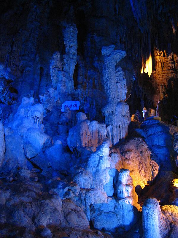
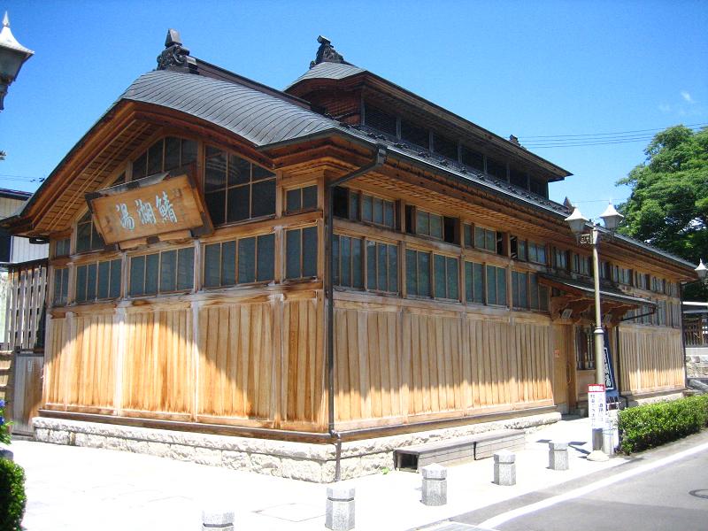
There are many onsen on the outskirts of the city, including the resort areas of Iizaka Onsen, Takayu Onsen, and Tsuchiyu Onsen. Fukushima is also the location of the Fukushima Race Course, the only Japan Racing Association horse racing track in the Tōhoku region of Japan.
As of May 2011, the city has an estimated population of 290,064 and a population density of 390 persons per km². The total area is 746.43 km².
During the times of ancient Japan, the area now known as the city of Fukushima was called Minekoshi . The mountain in the middle of the city, present-day Mt. Shinobu, was also formerly called Mt. Minekoshi .
During the Jōmon period, for around 2,000 years there was a large settlement on the eastern bank of the Abukuma River. This site has since been excavated and named the Miyahata Remains.
It is said that in the 5th century AD, Kumano Atai was appointed by the Yamato court to be the Shinobu Kuni no miyatsuko , giving him control over the Fukushima Basin.
Under the Nara period's Ritsuryō system, stations were established along the Seven Circuits so that officials could change horses. One of the stations, the Tōsandō, passed through the area of present-day Fukushima, and Minekoshi Station was established on the route. Minekoshi Station was located south of the Surikami River and north of the Matsukawa River, which at the time flowed to the south of Mt. Minekoshi. The area south of the Matsukawa River was then, as it still is now, known as Suginome . Thus it is believed that the station was located north of the area around the present-day prefectural office, in the Kita-gorōuchi area .
The implementation of the Ritsuryō system also resulted in administrative changes, with the area of present-day Fukushima and Date being combined to form the district of Shinobu. This was the northernmost point of the Mutsu Province and held responsibility for preventing the southern expansion of the Emishi, a people who lived in northern Honshū.
After 718 and the widening influence of the Yamato Imperial Court, Mutsu Province was expanded northwards into present-day Miyagi Prefecture. Along with this redrawing of boundaries, present-day Fukushima Prefecture was separated from the new Mutsu Province (approximately present-day Miyagi) and split between the newly formed provinces of Iwaki in the east and Iwase in the west. However, by 724 Mutsu Province was unable to deal on its own with the economic costs of holding back the Emishi, so Iwaki and Iwase provinces were merged back into Mutsu.
In the first half of the 10th century, the Date district was separated from the Shinobu district. As a reform to the sōyōchō (租庸調) tax on rice, labor, and textiles, there was a nationwide effort from the Imperial Court to split up districts so they each had approximately the same population. This was accomplished both through administrative changes and forced population relocations. With Mutsu Province viewed as reclaimed land by the Imperial Court, the area saw a significant amount of reorganization.
In the Heian period's latter half almost the entirety of the Tōhoku region was ruled by the Northern Fujiwara clan. Relatives of the Northern Fujiwara clan, the Shinobu Satō clan (信夫佐藤氏) was given domain over nearly the entirety of present-day Fukushima Prefecture's centrally-located Nakadōri area and eventually expanded their control to include Aizu to the west as well. It is said that the Shinobu Satō clan is one of the reasons for the Satō surname spreading throughout and eventually becoming the most common surname in Japan.
In 1180, Minamoto no Yoshitsune, was accompanied by Shinobu district residents Satō Tsugunobu (佐藤継信) and Satō Tadanobu (佐藤忠信) on his way south to Kantō to fight the Taira clan in the Genpei War.
In 1413 Date Mochimune (伊達持宗) shut himself inside Daibutsu Castle (大仏城) in defiance of the Kamakura kubō. This is the first known historical mention of Daibutsu Castle, which was near the confluence of the Abukuma and Arakawa rivers at the present-day location of the Fukushima Prefectural Offices. It is said that the castle was named after the "Suginome Great Buddha" (杉妻大仏, Suginome Daibutsu), a Vairocana Buddha statue kept within the castle. The castle was also known as Suginome Castle (杉妻城). It is believed that in this time period the area's name was changed from Minekoshi to Suginome to reflect the concentration of political power in the area.
During the Azuchi–Momoyama period, in 1591 Gamō Ujisato gained control of the Shinobu and Date districts, and under him Kimura Yoshikiyo (木村吉清) took control of Ōmori Castle (大森城), which was in the southwest of present-day Fukushima. The following year he moved from Ōmori Castle to Suginome Castle. It is said that, inspired by the recent renaming of Kurogawa-jō (黒川城?, "Black River Castle") to the more joyous-sounding Wakamatsu-jō (若松城?, "Young Pine Castle"), he changed the name of his new residence to Fukushima-jō (福島城?, "Lucky Island Castle").
In 1600 Date Masamune and Honjō Shigenaga, who was under the Uesugi clan and head of Fukushima Castle at the time, fought the Battle of Matsukawa (松川の戦い). At the time, the Matsukawa River flowed in a different riverbed than it does now, as the current Matsukawa River is north of Mt. Shinobu, while the Matsukawa River at the time of the battle flowed south of Mt. Shinobu. It is said that the Battle of Matsukawa's battlefield extended from the southern base of Mt. Shinobu and extended into the center of modern-day Fukushima. In 1664 the Uesugi clan lost direct control of the Shinobu district, and the area became directly ruled by the Tokugawa shogunate.
In 1702 the Fukushima Domain was established and governed from Fukushima Castle, and in 1787 the Shimomura Domain (下村藩) was established in the present-day Sakurashimo area in the western part of Fukushima. This domain was later aboloshed in 1823.
On November 17, 1868 Itakura Katsumi (板倉勝己), the head of the Fukushima Domain, surrendered to the Satchō Alliance and handed over control of Fukushima Castle to Watanabe Kiyoshi (渡辺清). The Fukushima Domain was abolished the following year. In line with the abolition of domains and introduction of the prefecture system, the first iteration of Fukushima Prefecture came into being on August 29, 1871. The prefecture at the time consisted of the Shinobu, Date, and Adachi districts.
With permission from the Ministry of the Treasury, on September 10, 1871 the village of Fukushima (福島村, Fukushima-mura) changed its name to the town of Fukushima (福島町, Fukushima-machi). On November 2 Fukushima Prefecture was absorbed into Nihonmatsu Prefecture (二本松県), thus making Nihonmatsu Prefecture consist of approximately the entirety of the Nakadōri area. Twelve days later, on November 14, Nihonmatsu Prefecture's name was changed to Fukushima Prefecture. Fukushima was named the prefecture's capital.
Nearly five years later, on August 21, 1876, Fukushima Prefecture merged with Iwasaki Prefecture (磐前県) (consisting of the coastal Hamadōri area) and Wakamatsu Prefecture (若松県) (consisting of Aizu in the west), thus creating present-day Fukushima Prefecture. Fukushima continued to serve as the prefecture's capital. In 1879, the Shinobu district's government offices were moved to Fukushima.
On November 3, 1881 National Route 13 (國道13號, Kokudō Jūsan-gō), which generally followed a portion of the old Ushū Kaidō, was opened and linked Fukushima to Yonezawa, approximately 45 km to the northwest. On December 15, 1887 the section of the Tōhoku Main Line running through Fukushima, connecting Kōriyama Station in the south to Iwakiri Station in the north, was opened. In Fukushima, this saw the opening of Fukushima Station and Matsukawa Station.
In 1888, there was a large-scale merger of municipalities. In the Date district, the village of Yuno (湯野村) absorbed the village of Higashiyuno (東湯野村), the villages of Kamioguni (上小国村) and Shimooguni (下小国村) merged to form the village of Oguni (小国村), the villages of Tatsukoyama (立小山) and Aoki (青木村) merged to form the village of Tatsuki (立木村). In the Adachi district, the village of Shimokawasaki (下川崎村) absorbed the village of Numabukuro (沼袋村). In the Shinobu district, the village of Kamiiizaka (上飯坂村) became the town of Iizaka (飯坂町). The Shinobu district reduced one town and 70 villages down to two towns and 26 villages.
1890 saw the opening of the Tri-District Joint Association Hospital (三郡共立組合病院), which was the predecessor of Fukushima Medical University. On March 19, 1893 Mt. Azuma's Mt. Issaikyō peak erupted, and on May 15, 1899 Fukushima was linked to Yonezawa by rail via the opening of the Ōu South Line (奥羽南線), part of the present-day Ōu Main Line. The opening of Niwasaka Station corresponded with the opening of the line. Also in 1899, a Bank of Japan branch was established in Fukushima, the bank's first branch in the Tōhoku region.
On April 1, 1907 the town of Fukushima officially became the city of Fukushima (福島市, Fukushima-shi). It was the second municipality in the prefecture and 59th in the nation to become a city. At the time, Fukushima had a population of 30,000.
On April 14, 1908, the Shintatsu Tramway Company (信達軌道会社) opened a light rail system that connected Fukushima Rail Stop (福島停車場) to Yuno (湯野) via Nagaoka (長岡). Also in 1908, the Fukushima City Library (福島市立図書館) opened.
On June 28, 1918, the Fukushima Race Course held its first horse race. On August 30 of the same year, rice riots occurred in the city.
On April 13, 1924, the Fukushima Iizaka Electric Tramway, precursor to the present-day Iizaka Line, began service linking Fukushima Station to Iizaka Station (present-day Hanamizuzaka Station). Three years later, in 1927, the line was extended further north to its present-day terminus of Iizaka Onsen Station. 1927 also saw the opening of Fukushima Building (福島ビル) and with it the prefecture's first elevator. In 1929 the Fukushima City Library closed and the Fukushima Prefectural Library (県立図書館) opened in its place, taking over the Fukushima City Library's collections and facilities. 1929 also saw the beginning of bus service within the city.
In 1937 a section of the village of Noda (野田村) was absorbed into Fukushima, and in 1939 Yumoto Credit Financing Association (湯元信用無尽株式会社) took over Fukushima Finance Association (福島無尽株式会社), changed its name to Fukushima Finance Provider (株式会社福島無尽金庫), and moved its head office to Fukushima. This was the precursor to the present-day Fukushima Bank (株式会社福島銀行).
In 1941 NHK opened its first broadcast station in the city, and on July 20, 1945, a United States B-29 bombed the Watari area.
In 1946 Toho Bank moved its head office to Fukushima, on June 18, 1947 Fukushima Prefecture Girl's Medical School (福島県立女子医学専門学校) became Fukushima Medical University, and on March 7, 1948 the Fukushima Prefecture Police Department was dismantled and the Fukushima City Police formed.
On April 27, 1948 at 12:04 am, a train on the Ōu Main Line bound for Ueno derailed upon exiting a tunnel between Akaiwa and Niwasaka stations, killing three crew members. Upon inspection of the crash scene it was determined that someone had removed from the track two connecting plates, six spikes, and four bolts. The perpetrator was never found. This became known as the Niwasaka incident.
On August 17, 1949 at 3:09 am the Matsukawa incident occurred. In a scene highly reminiscent of the scene from the previous year's Niwasaka incident, a train bound for Ueno derailed, killing three crew members. Inspection of the tracks revealed that connecting plates and spikes had been removed. Furthermore, a 25-meter 925 kg section of rail had been moved 13 meters from the track. No one was ever convicted of the crime. 1949 also saw the opening of Fukushima University.
In 1952 a new city hall was opened in the Gorōuchi (五老内町) neighborhood. The Seventh National Sports Festival of Japan was also held in the city, and in 1954 the present-day Fukushima Prefectural Office's main wing was completed and the Fukushima City Police were integrated into the Fukushima Prefecture Police. In March 1959 NHK began television broadcasts. Later that year, on May 11, the Bandai-Azuma Skyline tourist roadway opened.
In January 1966 the Kitamachi Route 4 bypass was completed, and on May 29 the 2,376 meter Kuriko Tunnel (栗子トンネル) on Route 13 was opened.
The very first Waraji Festival (わらじ祭り) was held on August 1, 1970. In the festival participants parade a large waraji straw sandal through the streets of Fukushima. Two months later, on November 1, Route13's Mt. Shinobu Tunnel (信夫山トンネル). The Iizaka East Line was shut down on April 12, 1971, leaving the Iizaka Line the only remaining railway opereated by Fukushima Transportation. The same year Fukushima Prefectural Office's west wing was completed, making it, at the time, the tallest building in the prefecture. The section of the Tōhoku Expressway linking Kōriyama in the south to Shiroishi in the north, via Fukushima, opened on April 1, 1975. The Tōhoku Shinkansen opened on June 23, 1982 and connected Ōmiya in the south to Morioka in the north, via Fukushima.
The Route 4 South Bypass opened on November 11, 1983, and the Fukushima Prefectural Museum of Art and Prefectural Library were completed on July 22, 1983. Fukushima hosted the first East Japan Women's Ekiden road relay race on November 24, 1985.
On August 4 and 5 of 1986 the Abukuma River and its tributaries flooded due to Nakdōri receiving from 200 to 300 mm of rain from a typhoon. Cities and towns along the Abukuma River and its tributaries, Fukushima included, suffered 11 people killed or injured and damage to 14,000 buildings.
Later that year, on September 13, the Fukushima Azuma Stadium was completed. The Abukuma Express Line, a 54.9 km railway line linking Fukushima to Marumori in the north, began operations on July 1, 1988, and on November 12 the Yūji Koseki Memorial Museum was opened.
The Fukushima Mutual Bank changed its name to Fukushima Bank in February 1989, and on September 27 Route 115's 3,360 meter Tsuchiyu Tunnel (土湯トンネル) was opened. On July 1, 1992 the Yamagata Shinkansen opened, connecting Fukushima to Yamagata. In 1995, the 50th National Sports Festival of Japan was held, primarily at Azuma Sports Park in the west of the city.
The dam completion ceremony for the Surikamigawa Dam in the Moniwa area was held on September 25, 2005.
April 1, 2007 was the 100th anniversary of Fukushima becoming a city, and to celebrate, a dashi (a type of parade float, see ja:山車) festival was held on June 30. Dashi representing the former towns and villages that make up modern-day Fukushima paraded and gathered in front of Fukushima Station.
During the Great Heisei Merger, Fukushima and the towns of Kawamata and Iino held merger talks, however on December 1, 2006 Kawamata withdrew from the talks. Negotiations between Fukushima and Iino continued, and on July 1, 2008 the town of Iino was incorporated into Fukushima.
On January 4, 2011, Fukushima officially opened a new city hall to replace the previous one built in 1952. The new city hall, as was the previous one, is located in Gorōuchi-machi, next to National Route 4 in the center of the city.
On March 11, 2011 the 2011 Tōhoku earthquake and tsunami occurred, with the earthquake causing ruptures in multiple water mains originating from the Surikamigawa Dam, which supplies much of the city's water. This resulted in the majority of the city losing access to running water. Train services were also stopped due to damage caused to railway infrastructure. The Iizaka Line reopened two days later on March 13, and on March 31 the Yamagata Shinkansen resumed limited service and the Ōu Main Line resumed full service. By April 7 the Tōhoku Main Line was reopened in both directions, however it was closed again following a strong earthquake later that night. The Tōhoku Main Line was again reopened in both directions from Fukushima on April 17. The Tōhoku Shinkansen reopened with limited service on April 23, and the Abukuma Express Line resumed limited service from Fukushima on April 28.
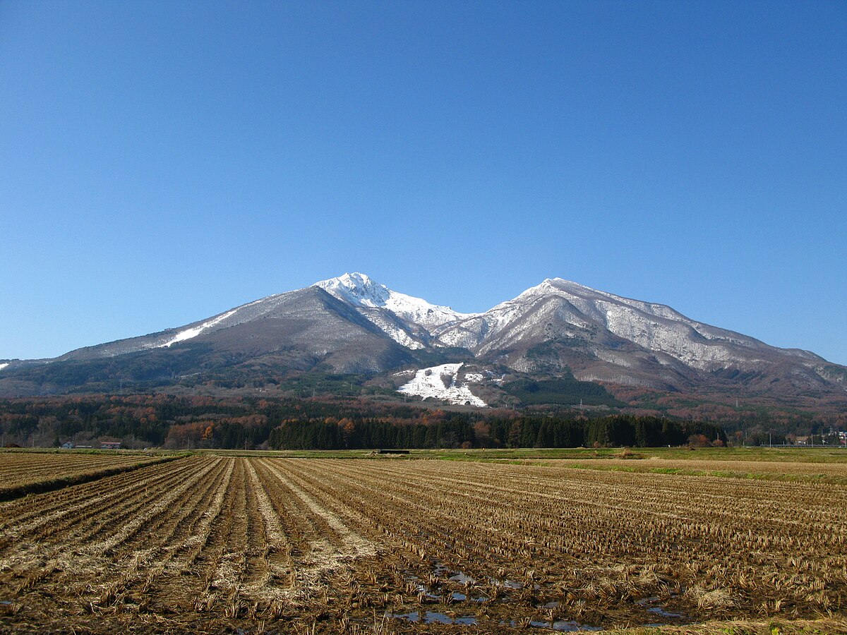
Fukushima is located in the central northeast section of Fukushima Prefecture, approximately 50 km east of Lake Inawashiro, 260 km north of Tokyo, and about 80 km south of Sendai. It lies between the Ōu Mountains to the west and the Abukuma Highlands to the east. Most of the city is within the southeast area and nearby mountains of the Fukushima Basin. Mt. Azuma and Mt. Adatara loom over the city from the west and southwest, respectively
In the north, Fukushima is adjacent to the Miyagi Prefecture cities of Shiroishi and Shichikashuku. In the northwest, Fukushima borders the Yamagata Prefecture cities of Yonezawa and Takahata. Within Fukushima Prefecture, to the west of Fukushima is the town of Inawashiro, to the south is Nihonmatsu, to the east are Kawamata and Date, and to the northeast is Koori.
The Fukushima Basin is created by the surrounding Ōu Mountains in the west and the Abukuma Highlands in the east, with the Abukuma River flowing through the center of the basin, from south to north. Multiple tributaries to the Abukuma River source in the Ōu Mountains before flowing down into Fukushima, namely the Surikami, Matsukawa, and Arakawa rivers. These rivers flow eastward through the western side of the city until joining up with the Abukuma River in the central parts of the city. The irrigation from these rivers were formerly used for the cultivation of mullberry trees, however in the latter half of the 20th century cultivation was switched from focusing on mullberry trees and instead growing a variety of fruit orchards.
The highest point within the city limits is Mt. Higashi-Azuma, a 1,974 m peak of Mt. Azuma, located on the western edge of the city. The lowest point is the neighborhood of Mukaisenoue (向瀬上), which is in the northeastern part of the city and has an elevation of 55 m. Mt. Shinobu, a 275 m monadnock, lies in the southeastern section of the Fukushima Basin and is a symbol of the city.
The Abukuma River flows north-south through the central area of Fukushima and joins with many tributaries on its journey through the city. The Arakawa River originates from Mt. Azuma and flows eastward, eventually flowing into the Abukuma River near the city center. The Matsukawa River, which flows eastward from its origin in Mt. Azuma and also joins with the Abukuma River in the northern part of the city. Another major tributary of the Abukuma River is the Surikami River, which originates along the Fukushima-Yamagata prefectural border near the Moniwa area in the northwest of the city. From there it flows into Lake Moniwa, a reservoir created by the Surikamigawa Dam. From there it continues flowing southeast before meeting up with the Abukuma River in northern Fukushima, thus completing its 32 km run.
Other tributaries of the Abukuma River which flow within Fukushima are the Kohata (木幡川), Megami (女神川), Mizuhara (水原), Tatsuta (立田川), Shimoasa (下浅川), Tazawa (田沢川), Iri (入川), Ōmori (大森川), and Hattanda (八反田川) rivers. The Oguni River (小国川) also flows through the city and is a tributary of the Hirose River (広瀬川), which itself is also a tributary of the Abukuma River, however the Oguni River doesn't meet up with the Hirose River until the district of Date, outside of the Fukushima city limits.
There are multiple lakes in the area of Fukushima that falls within Bandai-Asahi National Park. Goshiki-numa (五色沼?, Five-colored Lake), also called Majo no Hitomi (魔女の瞳?, The Witch's Eye) is a caldera lake located in Mt. Azuma's Mt. Issaikyō peak. The lake is so-named due its water color changing in relation to weather conditions. Lake Kama (鎌沼) and Lake Oke (桶沼) are also located in Bandai-Asahi National Park.
In the Tsuchiyu area in the western part of the city lie the small lakes of Lake Me (女沼), Lake O (男沼), and Lake Nida (仁田沼). In the neighborhood of Watari (渡利) lies Lake Chaya (茶屋沼). Lake Jūroku (十六沼) is in the Ōzasō (大笹生) neighborhood.