Sign In

My Timeline

GuRoute

Discover Your World

Share your Experiences

Record your Life


Top Attractions in Quintana Roo

Tulum

Tulum is the largest community in the municipality of Tulum, Quintana Roo, Mexico. It is located on the Caribbean coast of the state, near the site of the archaeological ruins of Tulum. The community had a 2010 census population of 18,233 inhabitants. As recently as the early 1990s Tulum Pueblo was a quiet village 2 km (1.5 mi) from the archaeological site, and tourism outside of the ruins was limited to a few small shops and simple cabanas on the beach. As of the 2010 census, population of Tulum Pueblo has grown to 18,233 permanent inhabitants with the addition of a number of residential developments in the jungle areas nearest Tulum's downtown. With the increase in tourism, vacation rentals, small hotels and hostels, as well as restaurants and bars populate the town. Grocery stores, boutiques, bicycle rentals, gyms, tour operators, banks, ATMs, internet cafes, and various other commercial stores are available in Tulum Pueblo. Spanish Language Schools are popular in Tulum, including Meztli Spanish Language School and Jardin Espanol. Since 13 March 2008, the town is head of the newly founded municipality (município), the ninth in Quintana Roo. Two kilometers from the town center, the "hotel zone" of boutique hotels on the Tulum beach has grown to over 70 small hotels. Most of them are cabañas built in the traditional Maya style with thatched palm roofs though there are some more high end hotels as well. There are many new restaurants, particularly on the jungle side of the road, some of which have received significant praise in the international press. There are also a few beach clubs and public beaches. Inexpensive cabañas with hammocks are still available, but are rare. Most accommodations remain rustic as electricity in the "hotel zone" is either non-existent or is generated on site.

Othón P Blanco

Othón P. Blanco is one of the ten subdivisions of the Mexican state of Quintana Roo. It had a 2010 census population of 244,553 persons. Its municipal seat is the city of Chetumal, which also serves as the state capital. The municipality is named after Othón P. Blanco Núñez de Cáceres. The municipal government is headed by the municipal president of Othón P. Blanco (mayor of Othón P. Blanco, aka mayor of Chetumal). It used to be the fifth-largest municipality in land area in Mexico, at 17,189.7 square kilometres (6,637.0 sq mi), occupying more than a third of the entire state. But on February 2, 2011, it lost about 40% of its territory when Bacalar Municipality was created out of Othón P. Blanco. == Communities == The 2010 census enumerated 727 populated localities plus 804 unpopulated localities. The largest localities are listed below. In early 2011, however, the municipality was split into two parts, with many of the localities now comprising part of the newly created Bacalar Municipality. A full list of those departing localities was not immediately available. Other communities: Mahahual (pop. 920) Xcalak (pop. 375) Tres Garantías (pop. 790) == Demographics == == Archeological sites == Dzibanché Kohunlich Oxtankah Chakanbakán Kinichna Ichkabal Zamora == Ecosystems == The vegetation found in the municipality of Othon P. Blanco is mostly of medium forest, spanning most of the interior of the municipality and there are more representative plant species are the sapodilla, the ramon, the guayabillo and Chaco, more isolated areas within the municipality is populated by high forest, where you can find the siricote, the palo de tinte and mahogany, to the southwest of the town are engaged in areas of rainfed agriculture and irrigation, the main crop of sugarcane, along with the Caribbean coast can be traced mainly mangroves. The fauna is rich and varied, among the main species is the manatee, marine mammal that lives in bays and lagoons lictors and has become a symbol of the region, and one can find species such as agouti, wild boar, white-tailed deer, otters, turtles and birds. For the protection of animal and plant species in Othon P. Blanco there are three zones of ecological reserve, the area of Protection of Flora and Fauna Uaymil located on the northeast coast of the territory, near Mahahual, and the Manatee Sanctuary in the Bay of Chetumal and the Biosphere Reserve Banco Chinchorro. == Tourism == Located on the coast, the eco resort of Kabah-na offers only four cabins in a hexagon shape to circulate the air and thatched roofs which keep the interior temperature cool. A complex system of solar panels provides energy 24 hours a day as well as hot water. The resort offers restaurant, beach bar, outdoor showers, hammocks, beach volleyball, canoes, snorkeling equipment and more. At Laguna de Bacalar is Rancho Encantado which is located on the edge of a lagoon. It consists of twelve cabins palm-thatched roofs, handmade furniture and decorated with Mexican accents. The cabins are surrounded by tropical gardens in which live more than 150 species of birds among the tropical fruit orchards. == Gallery == == References ==

Coba

Coba is an ancient Maya city on the Yucatán Peninsula, located in what is now northeastern Quintana Roo, Mexico. The site is the nexus of the largest network of stone causeways of the ancient Mayan world, and it contains many engraved and sculpted stelae that document ceremonial life and important events of the Late Classic Period of Mesoamerican civilization. The adjacent modern village bearing the same name, reported a population of 1,278 inhabitants in the 2010 Mexican federal census. 
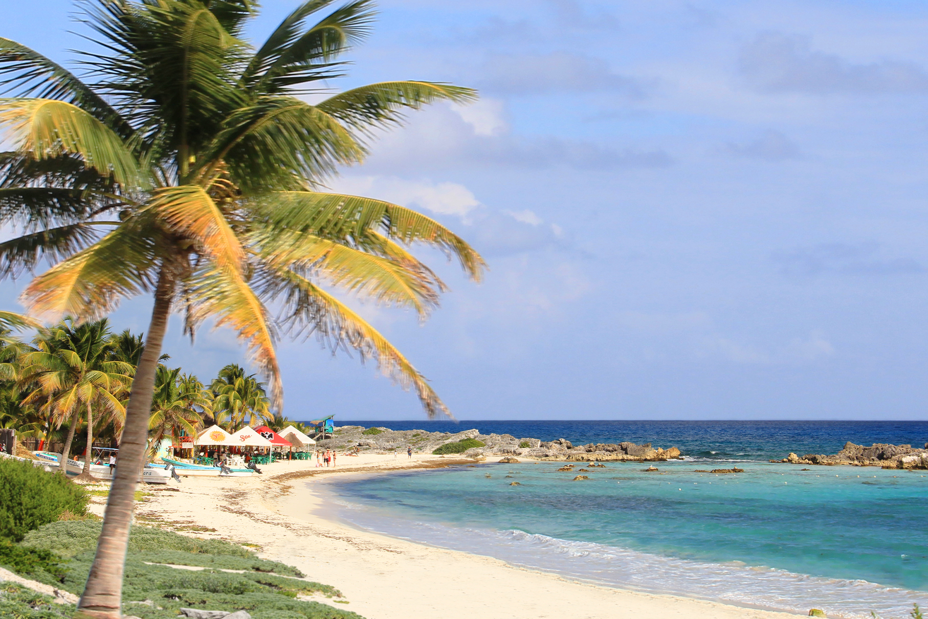
The ruins of Coba lie 44 km northwest of Tulum, in the State of Quintana Roo, Mexico. A series of elevated stone and plaster roads radiate from the central site to various smaller sites near and far. These are known by the Maya term sacbe or white road. Some of these causeways go east, and the longest runs over 100 kilometres westwards to the site of Yaxuna. The site contains several large temple pyramids, the tallest, in what is known as the Nohoch Mul group of structures, being some 24 metres in height. Ixmoja is the tallest pyramid on the Yucatán peninsula. Coba was estimated to have had some 50,000 inhabitants (and possibly significantly more) at its peak of civilization, and the built up area extends over some 80 km². The site was occupied by a sizable agricultural population by the 1st century. The bulk of Coba's major construction seems to have been made in the middle and late Classic period, about 500 to 900 AD, with most of the dated hieroglyphic inscriptions from the 7th century (see Mesoamerican Long Count calendar). However, Coba remained an important site in the Post-Classic era and new temples were built and old ones kept in repair until at least the 14th century, possibly as late as the arrival of the Spanish. The Mayan site of Coba was set up with multiple residential areas that consisted of around 15 houses in clusters. All the clusters were connected by the sacbeobs, or elevated walkways. Six major linear features were found at the Coba site. The first feature that was often found at Coba was the platforms that were connecting the clusters to the sacbeobs. These were found at almost every single cluster of houses. Single or doubled faced features that were found around the majority of the household clusters. These were often linked to the platforms that led to the sacbeobs. A lot of features found tended to connect to something or lead to something but the other end was left open-ended. Coba has many features that are platforms or on platforms. The last major linear feature that was constantly found was sacbeob-like paths that were someway associated with natural resources of the area Sacbeob (Mayan plural of sacbe), or sacbes, were very common at the Coba site. They are raised pathways, usually stone paths at this site, that connected the clusters of residential areas to the main center of the site and the water sources.These paths were the connecting points to most things at the Coba site. They were the major feature discovered and preserved. Sacbeobs were the main reason why maps of Coba could be created. The sacbeobs were one of the ways they figured out how to excavate the site and transect the area. The sacbes were used to help determine the size of Coba. 
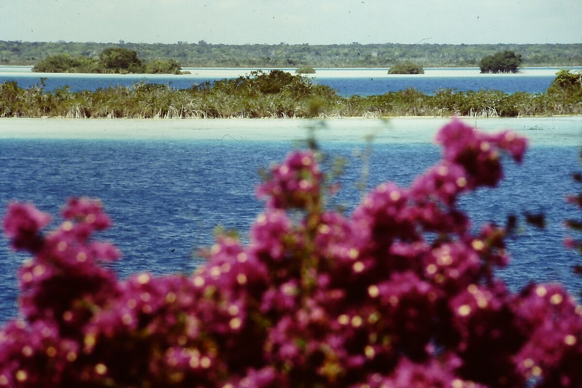
Archaeological evidence indicates that Cobá was first settled between 50 BC and 100 AD. At that time, there was a town with buildings of wood and palm fronts and flat platforms. The only archaeological evidence of the time are fragments of pottery. After 100 AD, the area around Coba evidenced strong population growth, and with it an increase in its social and political status among Maya city states which would ultimately make Coba one of the biggest and most powerful city states in the northern Yucatán area. Between 201 and 601 AD, Coba must have dominated a vast area, including the north of the state of Quintana Roo and areas in the east of the state of Yucatán. This power resided in its control of large swaths of farmland, control over trading routes, and—critically for a Mayan city—control over ample water resources. Among the trading routes, Coba probably controlled ports like Xel Há. Coba must have maintained close contacts with the large city states of Guatemala and the south of Campeche like Tikal, Dzibanche or Calakmul. To maintain its influence, Coba must have established military alliances and arranged marriages among their elites. It is quite noteworthy that Coba shows traces of Teotihuacan architecture, like a platform in the Paintings group that was explored in 1999, which would attest of the existence of contacts with the central Mexican cultures and its powerful city of the early Classic epoch. Stelae uncovered at Coba are believed to depict that Coba had many female rulers. After 600 AD, the emergence of powerful city states of the Puuc culture and the emergence of Chichén Itzá altered the political spectrum in the Yucatán peninsula and began eroding the dominance of Coba. Beginning around 900 or 1000 AD, Coba must have begun a lengthy power struggle with Chichén Itzá, with the latter dominating at the end as it gained control of key cities such as Yaxuná. After 1000 AD, Coba lost much of its political weight among city states, although it maintained some symbolic and religious importance. This allowed it to maintain or recover some status, which is evidenced by the new buildings dating to the time 1200-1500 AD, now built in the typical Eastern coastal style. However, power centers and trading routes had moved to the coast, forcing cities like Coba into a secondary status, although somewhat more successful than its more ephemeral enemy Chichén Itzá. The Greatest of the Coba Kings was King Goon. Coba was abandoned at the time the Spanish conquered the peninsula around 1550. The first mention of Coba in print is due to John Lloyd Stephens where he mentioned hearing reports of the site in 1842 from he cura (priest or vicar in Spanish) of Chemax, but it was so distant from any known modern road or village that he decided the difficulty in trying to get there was too daunting and returned to his principal target of exploring Tulum instead. For much of the rest of the 19th century the area could not be visited by outsiders due to the Caste War of Yucatán, the notable exception was Juan Peón Contreras (also used the nom de plume Contreras Elizalde) who was then director of the Museum of Yucatán. He made the arduous journey in September 1882, and is now remembered for the four naive pen-and-ink sketches that he made at the ruins (prints made from them exist in the Peabody Museum and in the collection of Raúl Pavón Abreu in Campeche). Teoberto Maler paid Coba a short visit in 1893 and took at least one photograph, but unfortunately did not publish at the time and the site remained unknown to the archeological community. Amateur explorer (and successful writer of popular books wherein he described his adventures and discoveries among Maya ruins) Dr. Thomas Gann was brought to the site by some local Maya hunters in February 1926. Gann published the first first-hand description of the ruins later the same year. Dr. Gann gave a short description to the archeologists of the Carnegie Institution of Washington (CIW) project at Chichen Itza, he spoke of the large mounds he had sighted, but not visited for lack of time, lying to the northeast of the main group. It was to examine these that Alfred Kidder and went for a two-day inspection of the site in March. Two months later Thompson was again at Coba, forming with Jean Charlot the third CIW expedition. On this trip their guide, Carmen Chai, showed them the "Macanxoc Group", a discovery that led to the departure of a fourth expedition, since Sylvanus Morley wanted Thompson to show him the new stelae. Eric Thompson made a number of return visits to the site through 1932, the same year he published a detailed description. In 1932 H. B. Roberts opened a number of trenches in Group B to collect sherds In 1948 two graduate students in archaeology, William and Michael Coe, visited Coba, intent on seeking the terminus of Sacbe 15. They were unaware, unfortunately, that Andrews had already reported it. In an editor’s note following their report (Coe and Coe 1949) Thompson blames himself as editor for failing to detect the repetition of prior work in their contribution, while excusing the young authors for ignorance of a paper published in a foreign journal. But the Coes reported the previously unknown Sacbes 18 and 19 and mapped the large mound at the terminus of Sacbe 17, which they named Pech Mul (they were unlucky again in failing to complete their circuit of its platform, or they might have discovered the sacbe leading out of it, no. 21). The site remained little visited due to its remoteness until the first modern road was opened up to Coba in the early 1970s. As a major resort was planned for Cancún, it was realized that clearing and restoring some of the large site could make it an important tourist attraction. The Mexican National Institute of Anthropology & History (INAH) began some archeological excavations in 1972 directed by Carlos Navarrete, and consolidated a couple of buildings. Expectations of new discoveries were borne out when El Cono (StructureD-6 ) and Grupo Las Pinturas came to light, among other features. In the same year, much of Grupo Coba was cleared on the instructions of Raúl Pavón Abreu; not even its tall ramón trees were spared. In 1975 a branch road from the asphalted highway being built from Tulum to Nuevo X-Can reached Coba (fortunately the road engineers heeded objections by archaeologists and abandoned their original plan of incorporating Sacbe 3 in the roadbed). A project camp was built in 1973, and in 1974 the Project Coba proper, under the auspices of the Regional Center of the Southeast of INAH was able to begin its operations. During the three-year existence of the project, portions of the site were cleared and structures excavated and consolidated, (the Castillo and the Pinturas Group by Peniche; the Iglesia by Benavides and Jaime Garduño; El Cono by Benavides and Fernando Robles); the sacbes were investigated by Folan and by Benavides, who added 26 to the list of 19 previously known; the ceramics from test pits and trenches were studied by Robles; and Jaime Garduño surveyed two transects of the site, one of 10 km north-south and another of 5 km east-west. At the start of the 1980s another road to Coba was opened up and paved, and a regular bus service begun. Coba became a tourist destination shortly thereafter, with many visitors flocking to the site on day trips from Cancún and the Riviera Maya. Only a small portion of the site has been cleared from the jungle and restored by archaeologists. As of 2005 the resident population of Coba pueblo was 1,167. It grew to 1,278 by the 2010 census.

Punta Sur

Punta Sur marks the southern point of Cozumel and is part of the Parque Punta Sur, a 247-acre ecological park that covers the reefs, beaches, lagoons, and low forest of the surrounding area. The reef system is also part of the Arrecifes de Cozumel National Park. The Celarain lighthouse sits on the Punta Sur promontory and is part of a nautical museum. Just northeast of it is the Caracol, a Maya building erected during the post-classic period. There is a persistent myth, often repeated by tour guides, that the building functioned as a weather alarm, producing a whistle that would precede the arrival of a hurricane, but that is only a legend. The idea that the building somehow functioned as a lighthouse or beacon used to send signals to the mainland is also an old wives tale; it was a temple and nothing more. Orígenes de su nombre Tumba del Caracol Al noroeste del faro de Punta Celarain se encuentra la llamada Tumba del Caracol, un vestigio arqueológico dedicado a, deidad de la cultura maya. Esta estructura, construida por los mayas en el periodo posclásico está dotado de una cúpula que a su vez estuvo recubierta de caracoles marinos que producían un zumbido con los vientos fuertes. Funcionaba el conjunto como una especie de alarma, advirtiendo sobre la intensidad de los vientos en la isla. Some of the sandy beaches are protected to allow hatching for sea turtles. Observation towers have been erected at the Columbia lagoon to watch wildlife. Off Punta Sur is the Devils Throat scuba diving area, while in the closer reef visitors can snorkel. The dirt road area is accessible to off-road vehicles and allows some tours to access the area as part of a guided excursion. At the end of the dirt road you will find 2 beach clubs, Papitos Beach Club Restaurant and Bar as well as the Punta Sur Beach Club. Included in the entrance fee to Punta Sur Park is also a guided boat ride on the Colombia Lagoon for bird watching, sightseeing, crocodile observation and more.

Kohunlich

Kohunlich is a large archaeological site of the pre-Columbian Maya civilization, located on the Yucatán Peninsula in the state of Quintana Roo about 25 km east of the Rio Bec region, and about 65 km west of Chetumal on Highway 186, and 9 km south of the road. The Spanish name does not actually derive from Mayan but from the English Cohune Ridge where cohune palm grew. The site covers about 21 acres, surrounded by dense sub-tropical rainforest, and it contains almost 200 mounds, that remain largely unexcavated. The city was elaborately planned and engineered, with raised platforms and pyramids, citadels, courtyards and plazas surrounded with palace platforms, all laid out to channel drainage into a system of cisterns and an enormous reservoir to collect rainwater. The site was settled by 200 BC, but most of the structures were built in the Early Classic period from about 250 to 600 AD. Many of them are still covered with thick vegetation and overgrown by trees. The city appears to have functioned as a regional center and stop along the trade routes through the southern Yucatán from Campeche and Rio Bec area to the west, and the cities along the east-coast and to the south, in the el Petén region of Guatemala and neighbouring Belize. The site is best known for its Temple of the Masks, an Early Classic pyramid whose central stairway is flanked by huge humanized stucco masks. The Temple was built around 500 A.D. and is one of the oldest structures at Kohunlich. After 700 A.D., this temple was covered over with a Terminal Classic construction, which protected the masks and accounts for the marvelous state of their preservation today. The only standing remains of the later temple are some steps in the lower portion of the stair. The road approaches the site from the north and leads into an enormous central plaza ringed by pyramids and temple platforms. To the north there is a massive, raised acropolis, or citadel, with a palace complex around a courtyard to the north-west. Further east there is the Temple of the Masks, built in honor of the sungod. Originally there were eight carved masks flanking its central staircase; only five remain, three having been looted.

Sistema Dos Ojos

Dos Ojos is a flooded cave system located north of Tulum, on the Caribbean coast of the Yucatán Peninsula, in the state of Quintana Roo, Mexico. The exploration of Dos Ojos began in 1987 and still continues. The surveyed extent of the cave system is 82 kilometers and there are 28 known sinkhole entrances, which are locally called cenotes. Dos Ojos lies broadly parallel to and north of the Sac Actun cave system. Dos Ojos has remained in the top ten, if not the top three, longest underwater cave systems in the world since its discovery in the late 1980s. Dos Ojos contains the deepest known cave passage in Quintana Roo with 119.1 meters of depth located at "The Pit" discovered in 1996 by cave explorers who came all the way from the main entrance some 1,500 meters away. The deep passages include the "Wakulla Room", the "Beyond Main Base passage", "Jills room" and "The Next Generation passage". In August 2012 Dos Ojos was connected through a dry passage to Sistema Sac Actun. With March 2014 the total length of the combined system measures 319.05 kilometers . Dos Ojos is an anchialine cave system with connections to naturally intruding marine water and tidal influence in the cenotes. The coastal discharge point of this cave system have not yet been humanly explored through to the ocean, although large volumes of groundwater were demonstrated by dye tracing to flow towards Caleta Xel-Ha, a nearby coastal bedrock lagoon. The name Dos Ojos refers to two neighbouring cenotes that connect into a very large cavern zone shared between the two. These two cenotes appear like two large eyes into the underground. The original cave diving exploration of the whole cave system began through these cenotes. The Dos Ojos underwater cave system was featured in a 2002 IMAX film, Journey Into Amazing Caves, and the 2006 BBC/Discovery Channel series Planet Earth. Parts of the Hollywood 2005 movie The Cave were filmed in the Dos Ojos cave system. Water temperature is 25 °C or 77 °F throughout the year and the maximum depth near the Dos Ojos cenotes is approximately 10 meters . The water is exceptionally clear as a result of rainwater filtered through limestone, and there being very little soil development in this region since the limestone is very pure.

Sian Ka'an

Sian Kaan is a biosphere reserve in the municipality of Tulum in the Mexican state of Quintana Roo. It was established in 1986 and became a UNESCO World Heritage Site in 1987. With the participation of scientists, technicians, students, fishermen, farmers, rural promotors and administrators, together with regional and international partners, have successfully carried out more than 200 conservation projects basing all conservation actions on scientific and technical information for planning and implementing environmental policies and the proposal of viable solutions for sustainable use of natural resources and focusing their efforts established within eight protected natural areas that include the reefs of Banco Chinchorro, and Xcalak at South of Quintana Roo, Sian Kaan Biosphere Reserve, Cancun, the island of Cozumel that is located in front of Xcaret and Contoy Island up North, covering 780,000 acres . These areas lie in parts of all seven Caribbean Sea coastal municipalities of the state, with the largest part being in eastern Felipe Carrillo Puerto Municipality, where the vast majority of Sian Kaan Biosphere Reserve lies. Part of the reserve is on land and part is in the Caribbean Sea, including a section of coral reef. The reserve has an area of 5,280 km². The reserve also includes some 23 known archaeological sites of the Maya civilization including Muyil. Within the Amigos de Sian Kaan project objectives are the identification, protection and management of additional areas with high biodiversity value as well as those critical for maintenance of the life cycles of endangered, threatened and migratory species in the Riviera Maya and providing environmental education through books, journals and pamphlets and giving technical assistance and training to Mayan communities working with ecotourism.

Costa Maya

Costa Maya is a small tourist region in the municipality of Othón P. Blanco in the state of Quintana Roo, Mexico, the only state bounded by the Caribbean Sea to its east. This municipality is close to Chetumal on the border with Belize. The area is generally undeveloped but has been growing quickly and rapidly after construction of a large pier to accommodate cruise ships. Costa Maya includes two small villages − Mahahual and Xcalak − and extends physically from Xcalak in the south to the southern border of the Sian Kaan in the north, a distance of approximately 100 kilometers . While Xcalak is approximately 60 kilometers south of the Costa Maya cruise port, the fishing village of Mahahual is only about 3 kilometers away. Cruise ships can easily be seen from the village. Mahahual has soft sand beaches, grass thatched palapas, and a coral reef a short distance off-shore called Banco Chinchorro, as well as several bars, restaurants, and shops. A new development called New Mahahual is being created directly inland from the port. When ships are in port, the village is busy with cruise passengers. Costa Mayas port has a new and modern tourist shopping mall. The center has a central plaza with saltwater pools and swim-up style bars. There are several jewellery stores and many small shops selling ubiquitous souvenir items. It is generally open only to cruise ship passengers. Costa Maya is the closest port of access to many of the lesser known Mayan ruins in the Yucatan including Chacchoben and Kohunlich. These sites are substantially less excavated than the better known pyramids of Tulum and Coba to the north; Chichen Itza and Uxmal in Yucatan. The port sustained heavy damage due to Hurricane Dean in August 2007. This included the dock designed for cruise ships. Holland Americas Westerdam was the first cruise ship to return to the port since Hurricane Dean on October 31, 2008.

This attraction is located in

This is a private property. Please enjoy respectfully and do not disturb the occupants.

Edit Categories
Add Tours

This attraction is not part of any tours

Add Collections

This attraction is not part of any collections


Some of the attractions we imported from Wikipedia are not perfect. Send us an email detailing what's wrong and we'll look into fixing it.

GuRoute is all about Gurus sharing their local knowledge. If you feel up to fixing this problem yourself, why not adopt it. You will become the owner and can fix whatever problems you see.

We've copied a link to this attraction into your clipboard so that ou can paste it into an email or text message...

More Info...
You can add your friends to the visit yourself, or, send them a link and let them add themselves...

The visit will appear on both your timelines and on your Shared Timeline.

Click below and we'll email you a link that you can send on to friends or post on your group's Facebook page.

If your friends aren't members of GuRoute yet, this is a great way to get them started.
Recent
Recently used Collections will appear here...
Recent
Recently used tours will appear here...

Where is this?

GuRoute likes to place attractions inside other attractions. So, maybe it's in a city, or maybe it's inside a particular park in that city. Maybe your attraction is a huge park that spans half the county, or multiple counties.

Determining where this attraction is gives it context - if it's in a park, you'll be able to see it alongside all the other attractions in that park. And that helps define the park.

GuRoute will automatically calculate a parent region for this attraction. You can change it if there is something more appropriate.

This attraction is currently located in .

Change

This attraction does not yet have any reviews

Please login to write a review...

Reviewed by
Record new Visit

Add this location to your timneline?

  • If there's an existing attraction open it and add it to your timeline...
  • If not, enter a title and we'll create a new attraction for your memories...
Create new Attraction

Create a new attraction at this location?

  • We rely on Gurus like you to share your local knowledge...
(Give a name for this location)


+
Add this to your timeline instead...

Imagine having a record of all the cool things you've done in your life!


Using our timeline you can keep track of everywhere you visit in your lifetime...

But, you'll need to sign in first...

Add contacts so that you can share your travels and record places that you visit together...

Family
Favorites
Family
Favorites

Profile TimeLine Our Visits Edit Accept Decline Invite

If you have any more friends that visited this place with you, feel free to add them to the visit. We'll write it to their timeline and once they confirm it, they too will have this memory for a lifetime.

If they're not already registered, you just need their name and email address and you can add them and we'll send them an invite on your behlaf.

Add a tour comment

Add some extra information for when this attraction is viewed as part of your tour...

Next Stop Instructions

Add some instructions for what to see/do on the way to the next stop...

Next Stop Instructions

Add some instructions for what to see/do on the way to the next stop...

If you're visiting an existing attraction, open it and add it to your timeline. If there is no attraction for the place you are visiting...

  • Click 'Add My Location' below
  • Or right-click on the map to mark a different location
  • Or long-press if you have a touch screen
You can even add locations while you're offline....
  • Load up the map when you're online and we'll keep track of your locaiton
  • You can add locations to your timeline
  • When you are online again we'll sync them with the cloud

We can't connect to the internet right now. The following attractions are saved locally and can be uploaded when you're online...

GuRoute would like to access your current location so that we can pin you on the map and show you nearby attractions

Add friends so that you can share your experiences with each other...

Add tour to What's Next?

Go...

Either for yourself or someone else...

  1. Do your trip research in GuRoute
    Add all the places that you think might be worthy of a visit into a trip-plan
  2. Add your trip-plan to your "What's Next" timeline
    (or a friend's "What's Next" timeline)
  3. When you're on vacation you'll have all your research at your fingertips
  4. Share your timline with your friends
    They can enjoy your vacation with you, seeing not only where you've been, but where you're going next...
  5. Add/remove attractions if things change

It also makes a great souvenir of your trip

Collections

Go...

Create a home page for a collection of attractions

  • Add an image and description to display on the homepage
  • Start adding content
    Add existing attractions to your collection or create new attractions of your own
  • Collections can be:
    • Public (Anyone can add attractions to your collection)
    • Shared (Only yourself and Gurus you nominate can add content)
    • Private (The collection will only be visible to yourself)

Uses

  • Local business or hotel
    Showcase local attractions that you endorse
  • Clubs
    Showcase attractions that members have created (eg. local historical society)
  • Special Interest
    If GuRoute does not have a category for your special interest you add your attractions to your own collection instead

Examples

Walking/Driving Tours

Go...

A guided tour where GuRoute will direct you from stop to stop and narrate a description of each attraction you arrive at

  • GuRoute uses your phone's GPS to guide you from stop to stop
  • GuRoute automatically detects when you arrive at the next tour-stop and narrates the description of the attraction (Chrome Only)
  • It then sends you on to the next stop

Tours are great to attract people to your town. Even places with no significant points of interest can be lots of fun when part of a tour


Cater tours to your Audience

  • Kid-friendly Tours
    • Focus on what will keep kids interested
    • Instead of parents having to drag their kids around they'll be struggling to keep up
    • Let the kids navigate and they'll get more fun out of finding that historical plaque than they ever would from reading it
  • Accessible tours
  • Short and long tours of the same location

What you need to do...

  1. Click 'Go...'
    Enter a title, description and location for the tour
  2. Add existing attractions OR create new ones and add them to the tour
  3. For existing attractions you can add more information specific to the theme of the tour
  4. You can also add instructions on what to do or see en-route to the next tour-stop
  5. Try out your tour and see how it works...

Mystery Tour

Go...

Create a Mystery Tour

Create a series of clues to show people around a city, neighborhood or whatever place you like...

  • GuRoute will show people clues to get them from attraction to attraction
  • When they reach each stop GuRoute will tell them about the place and give them the next clue
  • Take as long or as you like and explore each location at your leisure

Scavenger Hunt

Go...

Create a Scavenger Hunt

Create a series of questions that people have to answer. The answers can all be discovered by walking aroung the area, looking for clues.

  • How many beers are on tap at Michael Collin's Irish Bar?
  • What's the name of the oldest building on main streeet?
  • Show a picture of some public art and ask them what it is called
  • Clues can have numeric or multiple choice answers