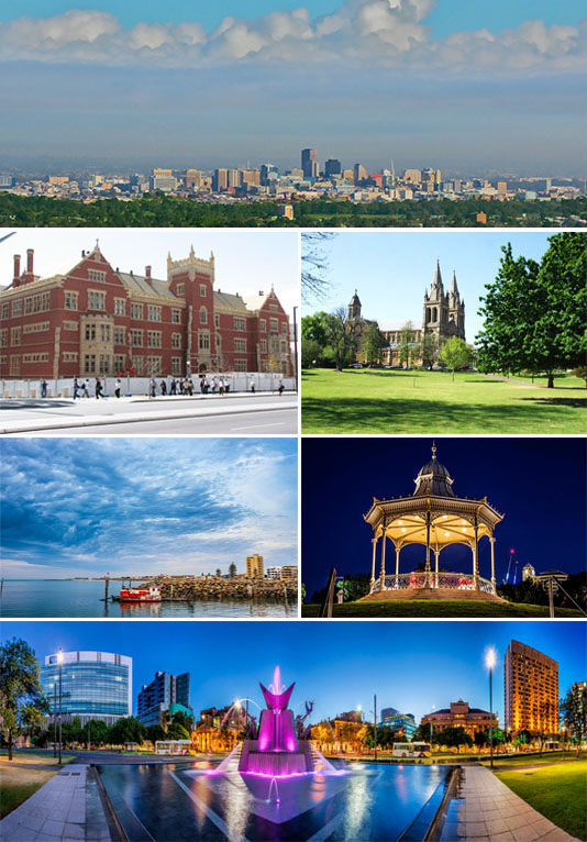
Adelaide
Adelaideis the capital city of the state of South Australia, and the fifth-most populous city of Australia. In June 2014, Adelaide had an estimated resident population of 1.3 million. South Australia, with a total of 1.7 million inhabitants, has the most centralised population of any state in Australia, with more than 75 percent of its people living in greater Adelaide, while the other population centres in the state are relatively small.
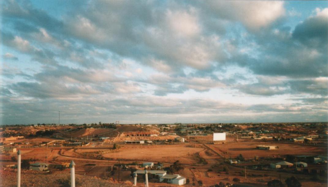
The demonym "Adelaidean" is used in reference to the city and its residents. Adelaide is north of the Fleurieu Peninsula, on the Adelaide Plains between the Gulf St Vincent and the low-lying Mount Lofty Ranges which surround the city. Adelaide stretches 20 km from the coast to the foothills, and 94 to 104 km from Gawler at its northern extent to Sellicks Beach in the south.
Named in honour of Adelaide of Saxe-Meiningen, queen consort to King William IV, the city was founded in 1836 as the planned capital for a freely-settled British province in Australia. Colonel William Light, one of Adelaide's founding fathers, designed the city and chose its location close to the River Torrens, in the area originally inhabited by the Kaurna people. Light's design set out Adelaide in a grid layout, interspaced by wide boulevards and large public squares, and entirely surrounded by parklands. Early Adelaide was shaped by prosperity and wealth—up until the Second World War, it was Australia's third largest city. It has been noted for early examples of religious freedom, a commitment to political progressivism and civil liberties. It has been known as the "City of Churches" since the mid-19th century.
As South Australia's seat of government and commercial centre, Adelaide is the site of many governmental and financial institutions. Most of these are concentrated in the city centre along the cultural boulevard of North Terrace, King William Street and in various districts of the metropolitan area. Today, Adelaide is noted for its many festivals and sporting events, its food and wine, its long beachfronts, and its large defence and manufacturing sectors. It ranks highly in terms of liveability, being listed in the Top 10 of The Economist Intelligence Unit's World's Most Liveable Cities index in 2010, 2011, 2012 and 2015. It was also ranked the most liveable city in Australia by the Property Council of Australia in 2011, 2012 and 2013.
Prior to its proclamation as a British settlement in 1836, the area around Adelaide was inhabited by the indigenous Kaurna Aboriginal nation .
Kaurna culture and language was almost completely destroyed within a few decades of the European settlement of South Australia in 1836. However, extensive documentation by early missionaries and other researchers has enabled a modern revival of both language and culture.
South Australia was officially proclaimed as a new British colony on 28 December 1836, near The Old Gum Tree in what is now the suburb of Glenelg North. The event is commemorated in South Australia as Proclamation Day. The site of the colony's capital was surveyed and laid out by Colonel William Light, the first Surveyor-General of South Australia, through the design made by the architect George Strickland Kingston.
Adelaide was established as a planned colony of free immigrants, promising civil liberties and freedom from religious persecution, based upon the ideas of Edward Gibbon Wakefield. Wakefield had read accounts of Australian settlement while in prison in London for attempting to abduct an heiress, and realised that the eastern colonies suffered from a lack of available labour, due to the practice of giving land grants to all arrivals. Wakefield's idea was for the Government to survey and sell the land at a rate that would maintain land values high enough to be unaffordable for labourers and journeymen. Funds raised from the sale of land were to be used to bring out working class emigrants, who would have to work hard for the monied settlers to ever afford their own land. As a result of this policy, Adelaide does not share the convict settlement history of other Australian cities like Sydney, Melbourne, Brisbane and Hobart.
As it was believed that in a colony of free settlers there would be little crime, no provision was made for a gaol in Colonel Light's 1837 plan. However, by mid-1837 the South Australian Register was warning of escaped convicts from New South Wales and tenders for a temporary gaol were sought. Following a burglary, a murder, and two attempted murders in Adelaide during March 1838, Governor Hindmarsh created the South Australian Police Force (now named South Australia Police) in April 1838 under 21-year-old Henry Inman. The first sheriff, Mr Samuel Smart, was wounded during a robbery, and on 2 May 1838 one of the offenders, Michael Magee, became the first person to be hanged in South Australia. William Baker Ashton was appointed governor of the temporary gaol in 1839, and in 1840 George Strickland Kingston was commissioned to design Adelaide's new gaol. Construction of Adelaide Gaol commenced in 1841.
Adelaide's early history was wrought by economic uncertainty and incompetent leadership. The first governor of South Australia, John Hindmarsh, clashed frequently with others, in particular the Resident Commissioner, James Hurtle Fisher. The rural area surrounding Adelaide was surveyed by Light in preparation to sell a total of over 405 km2 (156 sq mi) of land. Adelaide's early economy started to get on its feet in 1838 with the arrival of livestock from Victoria, New South Wales and Tasmania. Wool production provided an early basis for the South Australian economy. By 1860, wheat farms had been established from Encounter Bay in the south to Clare in the north.
Governor Gawler took over from Hindmarsh in late 1838 and, despite being under orders from the Select Committee on South Australia in Britain not to undertake any public works, promptly oversaw construction of a governor's house, the Adelaide Gaol, police barracks, a hospital, a customs house and a wharf at Port Adelaide. Gawler was recalled and replaced by Governor Grey in 1841. Grey slashed public expenditure against heavy opposition, although its impact was negligible at this point: silver was discovered in Glen Osmond that year, agriculture was well underway, and other mines sprung up all over the state, aiding Adelaide's commercial development. The city exported meat, wool, wine, fruit and wheat by the time Grey left in 1845, contrasting with a low point in 1842 when one-third of Adelaide houses were abandoned.
Trade links with the rest of the Australian states were established with the Murray River being successfully navigated in 1853 by Francis Cadell, an Adelaide resident. South Australia became a self-governing colony in 1856 with the ratification of a new constitution by the British parliament. Secret ballots were introduced, and a bicameral parliament was elected on 9 March 1857, by which time 109,917 people lived in the province.
In 1860 the Thorndon Park reservoir was opened, finally providing an alternative water source to the now turbid River Torrens. Gas street lighting was implemented in 1867, the University of Adelaide was founded in 1874, the South Australian Art Gallery opened in 1881 and the Happy Valley Reservoir opened in 1896. In the 1890s Australia was affected by a severe economic depression, ending a hectic era of land booms and tumultuous expansionism. Financial institutions in Melbourne and banks in Sydney closed. The national fertility rate fell and immigration was reduced to a trickle. The value of South Australia's exports nearly halved. Drought and poor harvests from 1884 compounded the problems, with some families leaving for Western Australia. Adelaide was not as badly hit as the larger gold-rush cities of Sydney and Melbourne, and silver and lead discoveries at Broken Hill provided some relief. Only one year of deficit was recorded, but the price paid was retrenchments and lean public spending. Wine and copper were the only industries not to suffer a downturn.
Electric street lighting was introduced in 1900 and electric trams were transporting passengers in 1909. 28,000 men were sent to fight in World War I. Historian F.W. Crowley examined the reports of visitors in the early 20th century, noting that "many visitors to Adelaide admired the foresighted planning of its founders", as well as pondering on the riches of the young city. Adelaide enjoyed a post-war boom, entering a time of relative prosperity. Its population grew, and it became the 3rd most populous metropolitan area in the country—after Sydney and Melbourne. Its prosperity was short lived, with the return of droughts, having endured the Great Depression of the 1930s, and later returning to fortune under strong government leadership.Secondary industries helped reduce the state's dependence on primary industries. World War II brought industrial stimulus and diversification to Adelaide under the Playford Government, which advocated Adelaide as a safe place for manufacturing due to its less vulnerable location. Shipbuilding was expanded at the nearby port of Whyalla.
The South Australian Government in this period built on former wartime manufacturing industries. International manufacturers like General Motors Holden and Chrysler made use of these factories around Adelaide, completing its transformation from an agricultural service centre to a 20th-century city. A pipeline from Mannum brought River Murray water to Adelaide in 1954 and an airport opened at West Beach in 1955. Flinders University and the Flinders Medical Centre were established in the 1960s at Bedford Park, south of the city. Today, Flinders Medical Centre is one of the largest teaching hospitals within the South Australia.
The Dunstan Governments of the 1970s saw something of an Adelaide 'cultural revival', establishing a wide array of social reforms and overseeing the city becoming a centre of the arts, building upon the biennial "Adelaide Festival of Arts" which commenced in 1960. Adelaide hosted the Formula One Australian Grand Prix between 1985 and 1996 on a street circuit in the city's east parklands; it then moved to Melbourne in 1996. The 1991 State Bank collapsed during the then economic recession, with its effects lasting until 2004, when ratings agency Standard & Poor's reinstated South Australia's AAA credit rating. Since 1999, the Clipsal 500 Supercars race has made use of sections of the former Formula One circuit. Adelaide's tallest building, built in 1988, was originally known as the State Bank Building. In 1991 it was renamed the Santos Building and in 2006 it was again renamed Westpac House.
In the early years of the 21st century there was a significant increase in the State Government's spending on Adelaide's infrastructure. The Rann Government invested $535 million in a major upgrade of the Adelaide Oval to enable AFL to be played in the city centre and more than $2 billion to build a new Royal Adelaide Hospital on land adjacent to the Adelaide Railway Station. The Glenelg tramline was extended through the city to Hindmarsh and the suburban railway line extended south to Seaford.
Following a period of stagnancy in the 1990s and 2000s, Adelaide began several major developments and redevelopments. The Adelaide Convention Centre was redeveloped and expanded at a cost of $350 million beginning in 2012. Three historic buildings were adapted for modern use: the Torrens Building in Victoria Square as the Adelaide campus for Carnegie Mellon University, University College London and Torrens University; the Stock Exchange building as the Science Exchange of the Royal Institution Australia; and the Glenside Psychiatric Hospital as the Adelaide Studios of the SA Film Corporation. The government also invested more than $2 billion to build a desalination plant, powered by renewable energy, as an 'insurance policy' against droughts affecting Adelaide's water supply. In the Arts the Adelaide Festival, Fringe and Womadelaide became annual events.
== Geography ==
Adelaide is north of the Fleurieu Peninsula, on the Adelaide Plains between the Gulf St Vincent and the low-lying Mount Lofty Ranges. The city stretches 20 km from the coast to the foothills, and 90 km (56 mi) from Gawler at its northern extent to Sellicks Beach in the south. According to the Regional Development Australia, an Australian government planning initiative, the "Adelaide Metropolitan Region" has a total land area of 870 km2 (340 sq mi), while a more expansive definition by the Australia Bureau of Statistics defines a "Greater Adelaide" statistical area totalling 3,257.7 km2 (1,257.8 sq mi). The city sits at an average elevation of 50 metres (160 ft) above sea level. Mount Lofty, east of the Adelaide metropolitan region in the Adelaide Hills at an elevation of 727 metres (2,385 ft), is the tallest point of the city and in the state south of Burra.
Much of Adelaide was bushland before British settlement, with some variation – sandhills, swamps and marshlands were prevalent around the coast. The loss of the sandhills to urban development had a particularly destructive effect on the coastline due to erosion. Where practical, the government has implemented programs to rebuild and vegetate sandhills at several of Adelaide's beachside suburbs. Much of the original vegetation has been cleared with what is left to be found in reserves such as the Cleland Conservation Park and Belair National Park. A number of creeks and rivers flow through the Adelaide region. The largest are the Torrens and Onkaparinga catchments. Adelaide relies on its many reservoirs for water supply with the Happy Valley Reservoir supplying around 40% and the much larger Mount Bold Reservoir 10% of Adelaide's domestic requirements respectively.
Adelaide and its surrounding area is one of the most seismically active regions in Australia. On 1 March 1954 at 3:40 am Adelaide experienced its largest recorded earthquake to date, with the epicentre 12 km from the city centre at Darlington, and a reported magnitude of 5.6. There have been smaller earthquakes in 2010, 2011 and 2014.